Minnesota parcels / Counties / Hennepin County
Hennepin County, MN GIS Map: Parcel Viewer, Owners and Land Use
MnGeo’s open parcel layer holds 447,044 parcels for Hennepin County. In GoGIS, Minnesota Parcels by County downloads all of them with every column the state publishes, owners, values, sales and addresses included, and colors them by land use. Once they’re on your iPhone, iPad or Android phone, GoGIS works as a Hennepin County parcel viewer: run a property search and tap any parcel with no signal. MnGeo’s copy of Hennepin County’s data is dated August 4, 2026; MnGeo gathers the open counties every quarter.
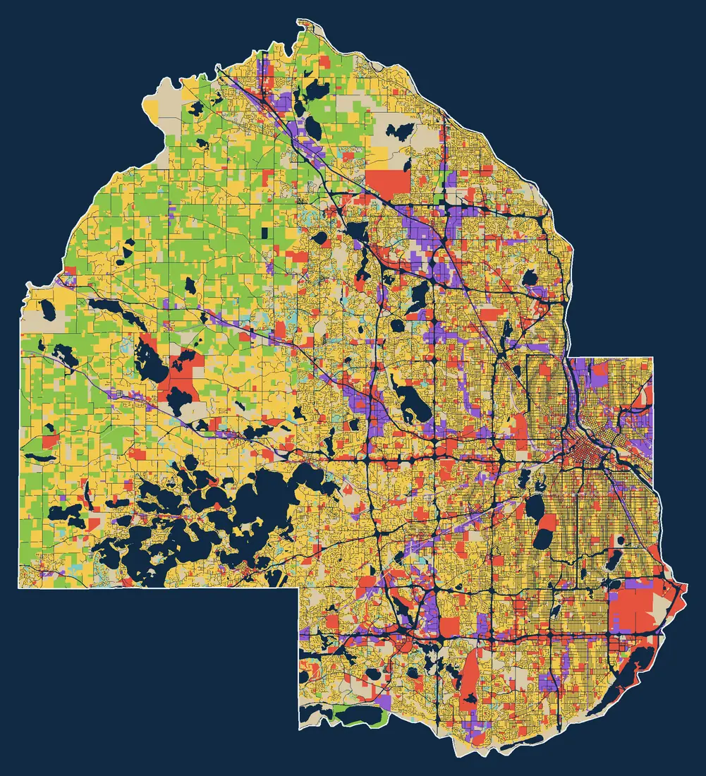
- Residential
- Agricultural
- Vacant
- Commercial
- Industrial
- Common Area
- Other
- Not Given
What you can do with it in GoGIS
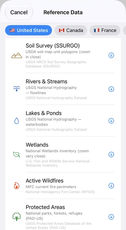
Download the data oncePick the layers you need from Reference Data. They stay on your phone and work with no signal.

Tap the map, even with no signalRead everything the publisher records about the parcel, field or area under your finger.

Photos, sketches and notesTake a picture where you stand, sketch on the map, and write down what you saw.

Your photos on the mapSee every photo where you took it, and share a PDF report of the place and your notes.
Land use in Hennepin County
By mapped area, Hennepin County is led by residential (49%), then vacant (15%) and agricultural (14%). By number, 90% of its parcels are residential.
| Land use | Parcels | Of parcels | Of area |
|---|---|---|---|
| Residential | 403,635 | 90% | 49% |
| Agricultural | 1,644 | under 1% | 14% |
| Vacant | 21,665 | 5% | 15% |
| Commercial | 11,411 | 3% | 13% |
| Industrial | 4,240 | under 1% | 6% |
| Common Area (HOA and condominium common land) | 3,787 | under 1% | 2% |
| Other | 33 | under 1% | under 1% |
| Not Given (nothing to classify by) | 629 | under 1% | 0% |
GoGIS sorts each state’s own land-use wording into these classes, with one color per class in every county, so Hennepin County reads like its neighbors. The county’s own wording stays in the record. Shares of area are measured from the map above.
What the Hennepin County records include
Counties fill the state’s columns differently. These are the columns GoGIS downloads for Hennepin County, and how many of its parcels have each one filled in, measured on November 10, 2026:
| Column in GoGIS | Filled in |
|---|---|
| Parcel ID | 100% |
| State Parcel ID | 100% |
| Address | 100% |
| ZIP Code | 100% |
| City | 100% |
| City / Township | 100% |
| Plat / Subdivision | 100% |
| Lot | 78% |
| Block | 72% |
| Legal Description | 39% |
| Section | 100% |
| Township (PLSS) | 100% |
| Range | 100% |
| Principal Meridian | 100% |
| Owner | 100% |
| Taxpayer | 100% |
| Taxpayer Address | 100% |
| Ownership Type | 100% |
| GIS Acres | over 99% |
| Land Use | over 99% |
| Land Use 2 | 2% |
| Land Use 3 | under 1% |
| Exempt Use | 4% |
| Tax Exempt | 100% |
| Multiple Uses | 100% |
| Homestead | 100% |
| Land Value | 95% |
| Building Value | 93% |
| Total Value | 95% |
| Tax Capacity | 95% |
| Property Tax | 95% |
| Special Assessments | 13% |
| Last Sale Date | 87% |
| Last Sale Price | 87% |
| Year Built | 94% |
| Garage | 100% |
| Basement | 100% |
| Green Acres | 100% |
| Ag Preserve | 100% |
| Open Space Program | 100% |
| School District | 100% |
| Watershed District | 96% |
Left empty by Hennepin County: Range Direction, Other Owners, Mailing Address, Deeded Acres, Assessment Year, Tax Year, Dwelling Type, Home Style, Finished Sq Ft, Dwelling Units, Garage Sq Ft, Heating and Cooling. GoGIS adds Land Use Class (the color).
Note: Minnesota counties choose each quarter which columns they share, so what’s filled in can change.
The owner columns (Owner, Taxpayer and Taxpayer Address) come with the county download as the state publishes them. This page never shows or samples them: look a parcel up in the app, or ask the county.
How to download Hennepin County parcels in GoGIS
- Open Reference Data. Tap Import, then Reference Data.
- Choose Minnesota Parcels by County. It’s with the United States datasets.
- Pick Hennepin County. GoGIS downloads all 447,044 parcels from MnGeo, colored by land use. With 447,044 parcels it’s a big download, so start it on Wi-Fi.
- Use it. Tap a parcel for its record, run a property search by address, parcel ID or owner name, or color the map by any column.
- Offline. The county stays on your device. Walk the land with your GPS position on the parcel lines, with no signal.
- Work through them in the attribute table. Filter Hennepin County’s parcels by Land Use Class, sort them by Total Value, total the GIS Acres with a column summary, and export the list to Excel as a CSV. See the attribute table on iPhone and iPad.
- Your own data on top. Add points, lines and photos, or lay soils, flood zones and other Reference Data over the parcels.
- Export. Share the parcels as a Shapefile, GeoPackage, KML, GeoJSON or CSV, or print a PDF map, with the publisher’s credit on it.
Parcel maps are not surveys. They’re drawn for tax assessment: good for finding a parcel and roughly where its lines run. For a boundary on the ground, the deed and a licensed surveyor have the last word.
Working near the county line?
Hennepin County borders Anoka County, Carver County, Dakota County, Ramsey County, Scott County, Sherburne County and Wright County. Download the neighbors too, and GoGIS shows them together in the same land-use colors.
Questions about the Hennepin County GIS map
Does Hennepin County have a GIS parcel map?
Yes. Hennepin County keeps its parcels and sends them to MnGeo, and MnGeo’s open parcel layer holds 447,044 of them. GoGIS downloads that copy straight from the state’s service and works as a Hennepin County GIS parcel viewer on your phone: nothing to unzip, no desktop GIS, and it works offline. It’s the state’s copy, not the county’s own map.
Is this the Hennepin County tax map or plat map?
It has the same parcels, but it isn’t the county’s official copy. A county tax map, or tax parcel map, shows the parcel lines and the tax details the assessor works from; a plat map or plat book shows the same lines with owners’ names. GoGIS works as a Hennepin County tax parcel viewer on your phone, with parcel lines, owner names, the total value and acreage. It isn’t a printed plat book or a survey: for a boundary on the ground, the deed and a licensed surveyor have the last word.
How do I do a Hennepin County property search on my phone?
Download Hennepin County in GoGIS, then open the layer’s attribute table and type into its search: a street address, a parcel ID or an owner’s name. It looks through every column on your phone, so it works with no signal. Tap a parcel for its record: the owner’s name, the property address, the total value, the last sale date, the last sale price and the acreage.
How do I find who owns land in Hennepin County?
Tap the parcel: 100% of Hennepin County parcels carry the owner’s name. Search an owner’s name to see every parcel under it. The owner can be a company, a trust or a public body, and a sale since the state’s last update won’t show yet; for deeds and recent sales, ask the Hennepin County None.
How current is the Hennepin County parcel data?
MnGeo’s copy of Hennepin County’s data is dated August 4, 2026; MnGeo gathers the open counties every quarter. GoGIS downloads straight from the state’s service, so you get what MnGeo publishes on the day you download, not a copy of ours. A sale, a split or a new survey shows up once the county has sent it in; to refresh, download Hennepin County again.
Does the Hennepin County map work without cell signal?
Yes, once it’s downloaded. Hennepin County stays on your iPhone, iPad or Android phone: the parcel lines, the property search and your GPS position all work with no signal. With 447,044 parcels it’s a big download, so start it on Wi-Fi.
More of Minnesota? See all 59 Minnesota county parcel maps, or the Minnesota statewide parcel guide.
Source: MnGeo, parcels compiled from opt-in open data counties. GoGIS is an independent app, not a government service.
Hennepin County in your pocket
Every parcel, colored by land use, on your iPhone, iPad or Android phone, offline.
Get GoGIS on the App Store Get GoGIS on Google Play