Slovenia's Land Cadastre on Your iPhone & iPad
The Geodetska uprava Republike Slovenije (GURS), the Surveying and Mapping Authority of the Republic of Slovenia, publishes the zemljiški kataster on a public WFS under CC BY 4.0. Unusually, each parcel carries its land-quality rating, the boniteta, from 1 to 100.
GoGIS has a Slovenia section in Reference Data. Move the map to your area, pick the dataset, and it downloads as a layer on your iPhone or iPad that you can read, search, combine with your own data and take into the field without a signal.
What you can do with it in GoGIS
Download the data oncePick the layers you need from Reference Data. They stay on your phone and work with no signal.

Tap the map, even with no signalRead everything the publisher records about the parcel, field or area under your finger.

Photos, sketches and notesTake a picture where you stand, sketch on the map, and write down what you saw.

Your photos on the mapSee every photo where you took it, and share a PDF report of the place and your notes.
What's in the Layer
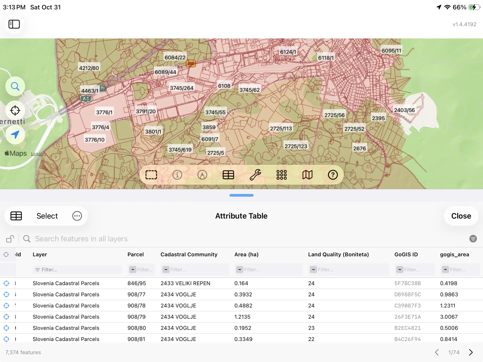
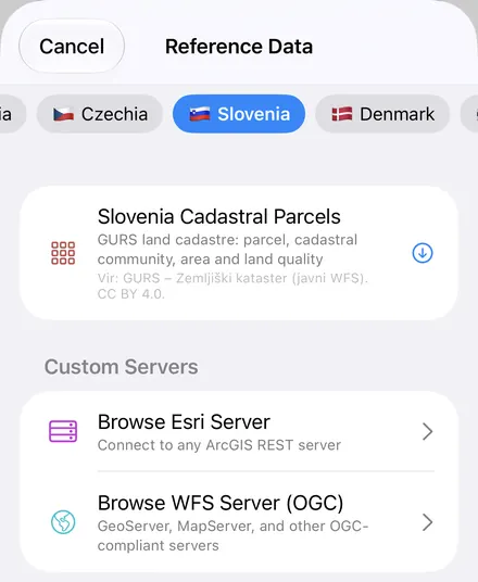
Slovenia Cadastral Parcels gives you each parcel's number, cadastral community, area in hectares and boniteta. Column names are in English, since Slovene isn't an app language. The service's layers on ownership aren't asked for. The layer arrives outlined and labeled by parcel number.
Vir: GURS – Zemljiški kataster (javni WFS). CC BY 4.0.
How to Download the Parcels
- Move the map to your area. Search for a town or an address, or pan and zoom to the land you want. GoGIS downloads what's on the screen. Parcels are small, so zoom in to a village or a few farms first.
- Open Reference Data. Tap Import, then Reference Data. The row of countries along the top opens on the one the map is showing, so with the map in Slovenia, the Slovenia dataset is the one listed.
- Choose the cadastre. The download keeps going if you switch apps, and progress shows on the map. When an area holds a great many parcels, GoGIS tells you how many and asks before it downloads them.
- Read the map. Tap a parcel for its number and cadastral community, and color the layer by boniteta to compare land quality across a holding.
What You Can Do with It
- Find a parcel in the field, offline. Walk to it with your GPS position on the map and the parcels on the screen. Once the layer is downloaded it works with no signal.
- Work through it in the attribute table. Filter the parcels by cadastral community, sort them by boniteta, total their area in hectares with a column summary, and export the list to Excel as a CSV. See the attribute table on iPhone and iPad.
- Combine it with your own data. Lay your own boundaries or sample points over the parcels, or use Intersect to see which parcels a buffer around a stream or a road touches.
- Export or print. Share the layer as a Shapefile, GeoPackage, KML, GeoJSON or CSV, or print a PDF map, with the credit on it.
Elsewhere? GoGIS also has the cadastres of Portugal, Luxembourg, Ireland, Czechia, Norway. See Reference Data by country for the rest.
Questions
Do the parcels show the owners?
No. GoGIS doesn't ask the service for its ownership layers.
Do I need desktop GIS software, an account or an API key?
No. GoGIS downloads from GURS's open service. There's no key, no account and nothing to unzip.
Slovenia's cadastre, in your pocket
Parcels you can read offline, on your iPhone or iPad.
Get GoGIS on the App Store Get GoGIS on Google Play