Vermont Soil Map on Your iPhone & iPad
Vermont's soils are mostly young, stony and on a slope: under 5 percent of the state is prime farmland, most of it in the valleys. The state soil, Tunbridge, is the most widespread, a well-drained loam of the wooded hills, usually mapped together with the shallower Lyman.
The USDA's soil survey maps 6.2 million acres of Vermont, field by field: which soil is where, whether it's prime farmland, how it drains and how much water runs off it. GoGIS puts that map on your iPhone or iPad, for wherever you're standing or any address you search, and keeps it there for when there's no signal.
| Vermont's farmland classes | Share of the state |
|---|---|
| All prime farmland | 4.6% |
| Prime farmland if drained | 1.2% |
| Farmland of statewide importance | 15.5% |
| Not prime farmland | 78.2% |
What you can do with it in GoGIS
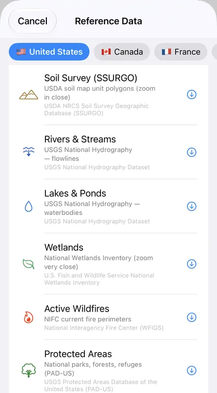
Download the data oncePick the layers you need from Reference Data. They stay on your phone and work with no signal.

Tap the map, even with no signalRead everything the publisher records about the parcel, field or area under your finger.

Photos, sketches and notesTake a picture where you stand, sketch on the map, and write down what you saw.

Your photos on the mapSee every photo where you took it, and share a PDF report of the place and your notes.
Vermont's State Soil, on the Map
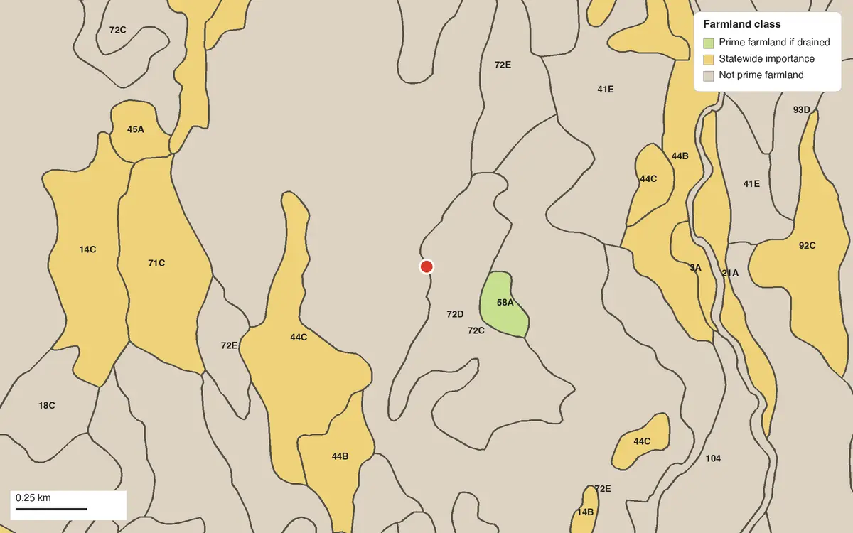
Here's a real spot of Tunbridge, Vermont's state soil, near Montpelier in Washington County, marked in red. These are the details GoGIS shows when you tap it:
| What you see | At this spot | What it means |
|---|---|---|
| Soil | Tunbridge-Lyman complex, 15 to 35 percent slopes, very rocky | The map unit: the soil series, its surface texture and its slope |
| Main soil | Tunbridge, 47% of the map unit | The soil that makes up most of it |
| Farmland class | Not prime farmland | The USDA's rating for farming |
| Drainage | Well drained | How fast water leaves the soil |
| Hydrologic soil group | C | runoff potential, A (low) to D (high) |
| Taxonomic class | Coarse-loamy, isotic, frigid Typic Haplorthods | The soil's scientific classification |
Vermont's soil map, in your pocket
GoGIS for iPhone, iPad and Android. Download the USDA soil map once and read it with no signal.
Get GoGIS on the App Store Get GoGIS on Google PlayVermont's Most Widespread Soils
| Soil series | Acres, as the main soil |
|---|---|
| Tunbridge (state soil) | 0.42 million |
| Cabot | 0.38 million |
| Peru | 0.33 million |
| Lyman | 0.26 million |
| Berkshire | 0.22 million |
| Vershire | 0.21 million |
| Buckland | 0.20 million |
| Marlow | 0.15 million |
USDA Natural Resources Conservation Service, Soil Survey Geographic Database (SSURGO), via Soil Data Access, 7 November 2026. Farmland shares are of all mapped acres; soil acres count each map unit's major soils by their share of it.
How to Read the Soil Anywhere in Vermont
- Find the place. Search for an address or coordinates, or stand there with your GPS on.
- Zoom in to the area you need. Soils are mapped in detail, and GoGIS downloads what's on the screen.
- Open Reference Data: tap Import, then Reference Data, and choose Soil Survey (SSURGO). The soils arrive colored by farmland class and labeled by soil.
- Tap the ground for the soil, its farmland class, drainage, hydrologic group and classification.
Next step: open the soil layer's attribute table to filter the map units by farmland class or drainage, search for Tunbridge by name, and export the list to Excel as a CSV. See the attribute table on iPhone and iPad.
More on soils: What type of soil do I have?, the USDA soil map and FEMA flood zones, and soil maps for Illinois, Iowa, Indiana, Kansas, South Dakota and Wyoming.
Questions
Does the soil map cover all of Vermont?
The USDA soil survey covers 6.2 million acres of Vermont. That's essentially the whole state.
Is this the same as Web Soil Survey?
Yes: the USDA's Soil Survey Geographic Database (SSURGO), the data behind Web Soil Survey. GoGIS downloads it for the area on your screen and keeps it on your phone.
Can I look up the soil at an address?
Yes. Search for the address in GoGIS, zoom in, download Soil Survey (SSURGO) for the area, and tap the spot.
How exact is it?
A map unit is drawn for its main soil but can hold small patches of others too small to map. It tells you what to expect, not what a soil test or a percolation test would find.
Does it work with no signal?
Yes, once downloaded. Download the soils while you have a signal; out in the field, tap the ground under your GPS position.
Vermont's soils, in your pocket
The USDA soil map of Vermont, ready to download on your iPhone or iPad.
Get GoGIS on the App Store Get GoGIS on Google Play