
WISCONSIN COUNTY PARCEL MAPS
Washington County parcel map and property owners
WI 2026 puts all 63,682 parcels in Washington County on your phone: owner names, site addresses, assessed values and acreage from the county’s 2025 tax roll. The county download is about 14 MB, and once it’s on your phone you can search it and tap any parcel with no signal.
The parcels cover 371,153 mapped acres across 20 towns, villages and cities, and 10 school districts. The most parcels are in the City of West Bend. The data is the State Cartographer’s Office V12 statewide parcel map, loaded from the county on March 6, 2026.
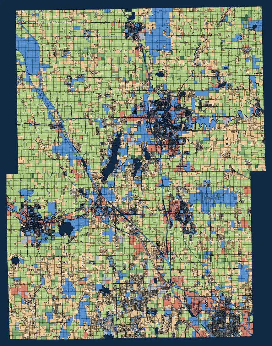
- Agricultural
- Productive forest
- Undeveloped / ag forest
- Residential
- Commercial / manufacturing
- Government-owned / county forest
- Other / unclassified
What the Washington County records include
Counties fill in the statewide schema differently. This is how complete Washington County’s 2025 records are:
| Field | Filled in |
|---|---|
| Owner name | 99.1% of parcels |
| Site (street) address | 95.9% of parcels |
| Assessed or estimated value | 93.4% of parcels |
| Assessed or deeded acres | 80% of parcels |
| Net property tax | 93.4% of parcels |
How the land is classed
By mapped area, Washington County is residential 54%, agricultural 28%, government-owned / county forest 10%, commercial / manufacturing 4%. The median estimated fair market value of a residential parcel is $372,400, across 48,230 residential parcels with a value.
In WI 2026, open the legend and color the map by Class of Property to see the same picture, or by Estimated Fair Market Value to see where values rise and fall.
Deer season: public land and Managed Forest Law
The tax roll marks parcels that are government-owned or enrolled in Wisconsin’s forest tax programs. In Washington County:
- Federal-owned: 46 acres in 6 parcels
- State-owned: 15,032 acres in 727 parcels
- County-owned: 2,002 acres in 103 parcels
- Managed Forest Law, open to public hunting, fishing, hiking, sightseeing and cross-country skiing: 40 acres in 1 parcel
- Managed Forest Law, closed (no public access without permission): 5,001 acres
In WI 2026, color the map by Auxiliary Class of Property to see these parcels, and tap one for the owner and acreage. The acreages are whole-parcel areas from the tax roll: a parcel that is only partly enrolled counts in full, and the tax roll doesn’t show posted areas or access routes. Before you hunt, check the DNR’s map of private forest land open to the public and the signs on the ground.
Towns, villages and cities in Washington County
Every parcel carries its municipality, so you can search a town name in WI 2026 or filter the attribute table to one place. Parcel counts in the 2025 data:
- City of West Bend 11,929
- Village of Germantown 8,761
- City of Hartford 6,154
- Village of Richfield 5,801
- Village of Jackson 3,256
- Village of Slinger 2,814
- Town of Trenton 2,528
- Town of West Bend 2,450
- Town of Polk 2,400
- Town of Jackson 2,323
- Town of Erin 2,196
- Town of Farmington 2,186
- Town of Addison 2,019
- Town of Hartford 1,916
- Village of Kewaskum 1,791
- Town of Wayne 1,631
- Town of Barton 1,543
- Town of Kewaskum 831
- Village of Newburg 459
- Town of Germantown 154
Working near the county line?
Washington County borders Dodge County, Fond du Lac County, Milwaukee County, Ozaukee County, Sheboygan County and Waukesha County. Download the neighboring counties too, and WI 2026 searches across all of them at once.
Where the data comes from
Parcel data is the Wisconsin Statewide Parcel Map Database (V12), a public-domain product of the Wisconsin Land Information Program and the State Cartographer’s Office, UW–Madison, built from Washington County’s 2025 tax roll. It is a snapshot, not a live feed: for a sale, a survey or a tax question, check with Washington County directly.