WISCONSIN PARCEL GUIDES
How to find a Wisconsin property owner by address
Start with the property’s street address, find the matching parcel, then read its owner information. WI 2026 lets you search downloaded Wisconsin county records on iPhone, iPad, or Android.
Looking into a property before a showing? Curious about the land next door? Here’s how to go from an address to the public parcel record.
1. Download the county where the property is located
In WI 2026, open Get More to reach Get Counties. Select the county you need and choose Download. Let the download finish before searching. You can download neighboring counties too, or all 72 if you want statewide coverage.
If you’re preparing for a trip, follow our guide to downloading Wisconsin parcel maps for offline use.
2. Search for the property’s address
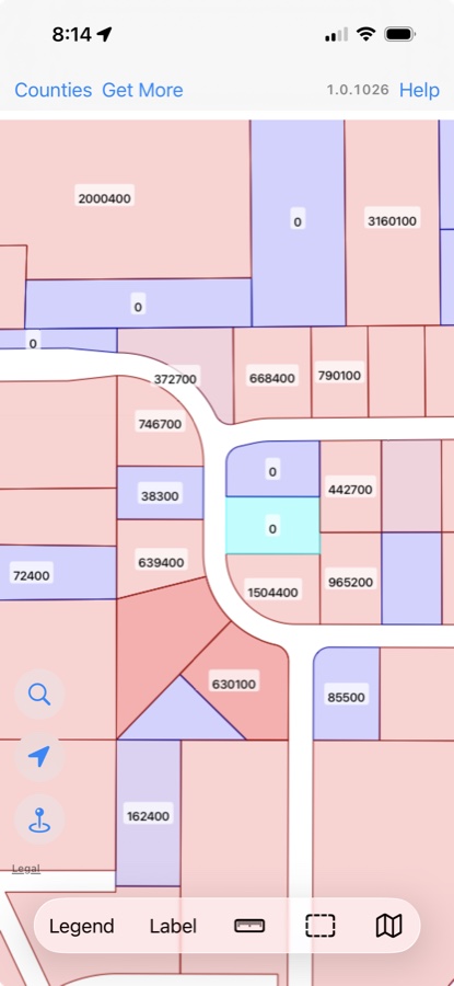
Open parcel search using the magnifying glass on the map. Search by the property’s street address, and use the relevant county or all your downloaded counties as the search area. You can also search by owner name or parcel ID if you already have that information.
Start with the street number and street name. If there is no match, try a shorter part of the address, such as the street name. Check spelling and try common address variations, such as “Highway” and “Hwy.” A vacant parcel may not have a street address; in that case, find the location on the map and select the parcel.
3. Filter and sort your search results
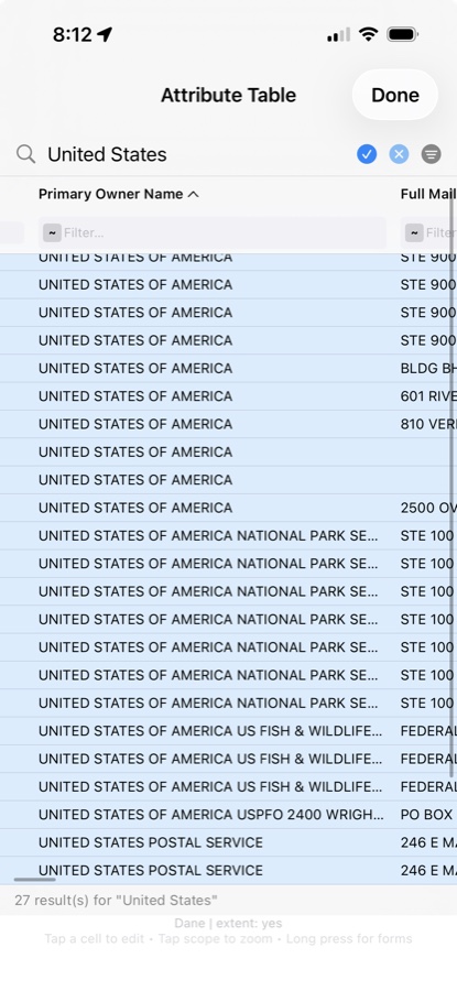
The results open in the Attribute Table—a grid with a row for each parcel and columns for its details. If a search finds more than one property, the table helps you narrow the list before opening a record.
- Filter to narrow the list
- Use the Filter… field beneath a column heading to narrow results using that column. For example, filter Primary Owner Name when you want to focus on a particular owner among your matches. Filtering changes which rows you see; it does not change the parcel records.
- Sort to put matches in order
- Tap a column heading to sort by that field. Tap again to reverse the order. The small arrow next to the heading shows the sort direction. In the screenshot, the arrow appears beside Primary Owner Name.
- Compare the right fields
- Scroll across the grid to see additional columns. Compare parcel addresses when a name matches several properties, or sort a numeric field such as acreage or assessed value when comparing land. Clear a column’s filter when you want to broaden the list again.
Search, filter, sort: search finds matching parcels, a column filter narrows those matches, and sorting puts the visible rows in order. If a parcel seems to be missing, check for an active filter before changing your search.
4. Open the matching parcel record
Review the search results and select the parcel you want to inspect. Check its location on the map so you don’t confuse similarly named streets or nearby properties.
Look for Primary Owner Name in the parcel details. The owner may be an individual, a company, a trust, or a public organization. Other available fields can include acreage and assessed values.
5. Check which address you’re reading
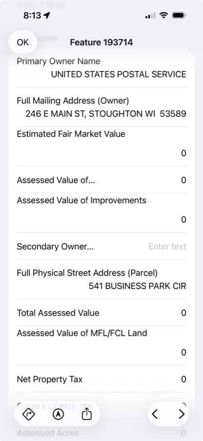
Full Physical Street Address (Parcel) identifies the property’s address. Full Mailing Address (Owner) is the mailing address listed for the owner. They may be different, so use the parcel address and map location to confirm you have the right property.
What if the owner name is missing?
Some counties redact owner names, including Kenosha. A blank name does not necessarily mean your search failed. Downloading the data again will not reveal a name that the county has withheld.
For a recent sale or a question about current ownership, check with the county. WI 2026 uses the statewide V12 (2026) dataset, rather than a live feed of property transfers. The Wisconsin State Cartographer’s Office explains that statewide records can lag local information and recommends consulting local government for current details.
Parcel lines are a reference, not a property survey. Finding an owner’s name does not give permission to enter the land.