
WISCONSIN PARCEL GUIDES
How to add photos, sketches, and notes to Wisconsin parcels
WI 2026 lets you keep photos, sketches, and written notes with a parcel. Take a picture while you’re there, or choose one from your photo library later. Save the details together so they’re easy to find the next time you open the map.
A view worth remembering, a fence that needs attention, or a detail from a property visit: your photos tell part of the story. A sketch and a few words help you remember the rest.
This example uses Lake Michigan beach photos and a sample fence observation. The images demonstrate the tools; not every photo shown depicts the selected property.
1. Find the parcel you want to remember
Open a county you’ve downloaded, find the place on the map, and select its parcel. If you need help finding it, follow our property owner and address search guide.
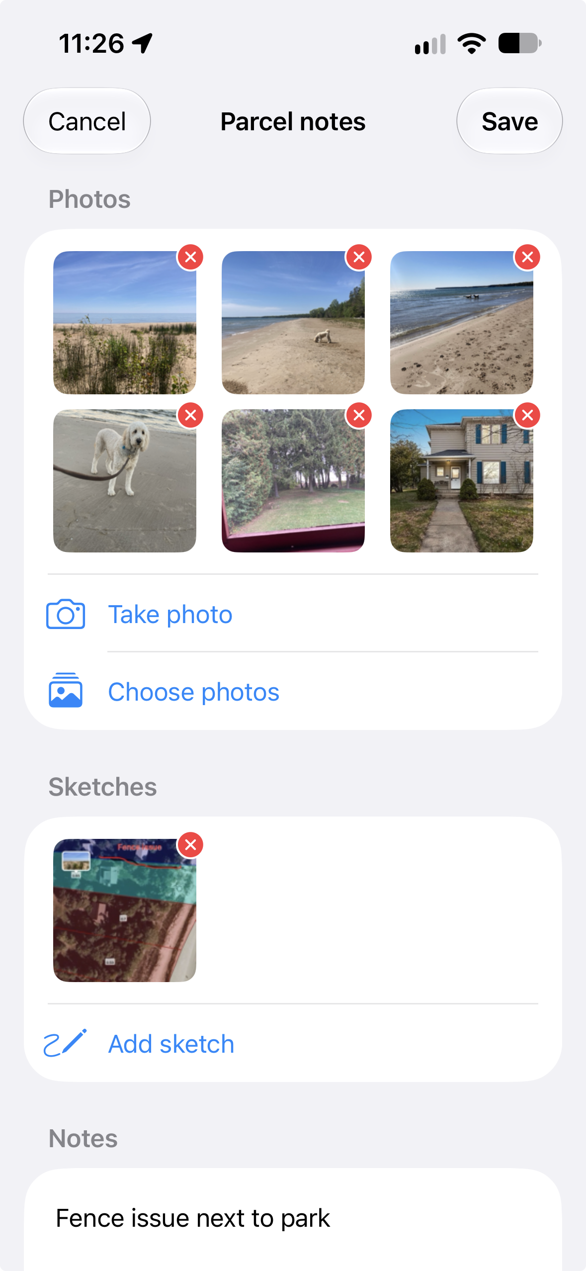
With the parcel selected, use the photos button on the map—the picture icon above the magnifying glass—to open Parcel notes. That’s where the photos, sketches, and text for the parcel are kept.
2. Take a photo or add one you already have
Under Photos, choose Take photo to capture something during a visit, or Choose photos to attach pictures from your library. You don’t have to be standing on the property to add a picture you took earlier.
For this example, beach photos from a previous Wisconsin visit were added from the photo library. Several pictures can help capture different views or details without trying to fit everything into a single shot.
3. Sketch the detail that matters
Choose Add sketch under Sketches. Use a sketch to mark an area or show something that’s difficult to describe with words alone.
In the example, the sketch marks a fence issue. Other useful sketches might show an area to revisit or a feature you want someone else to notice. Your sketch is a personal annotation; it does not change the public parcel boundaries.
4. Write a note and save
Add a short description in Notes. “Fence issue next to park” connects the observation to the sketch. For a real visit, including the date and what you want to check next can make the note more useful later.
Tap Save at the top of Parcel notes when you’re finished. Your photos, sketches, and notes stay on your device, attached to that parcel. They don’t change the public owner, acreage, or assessment information.
5. Find your photos on the map
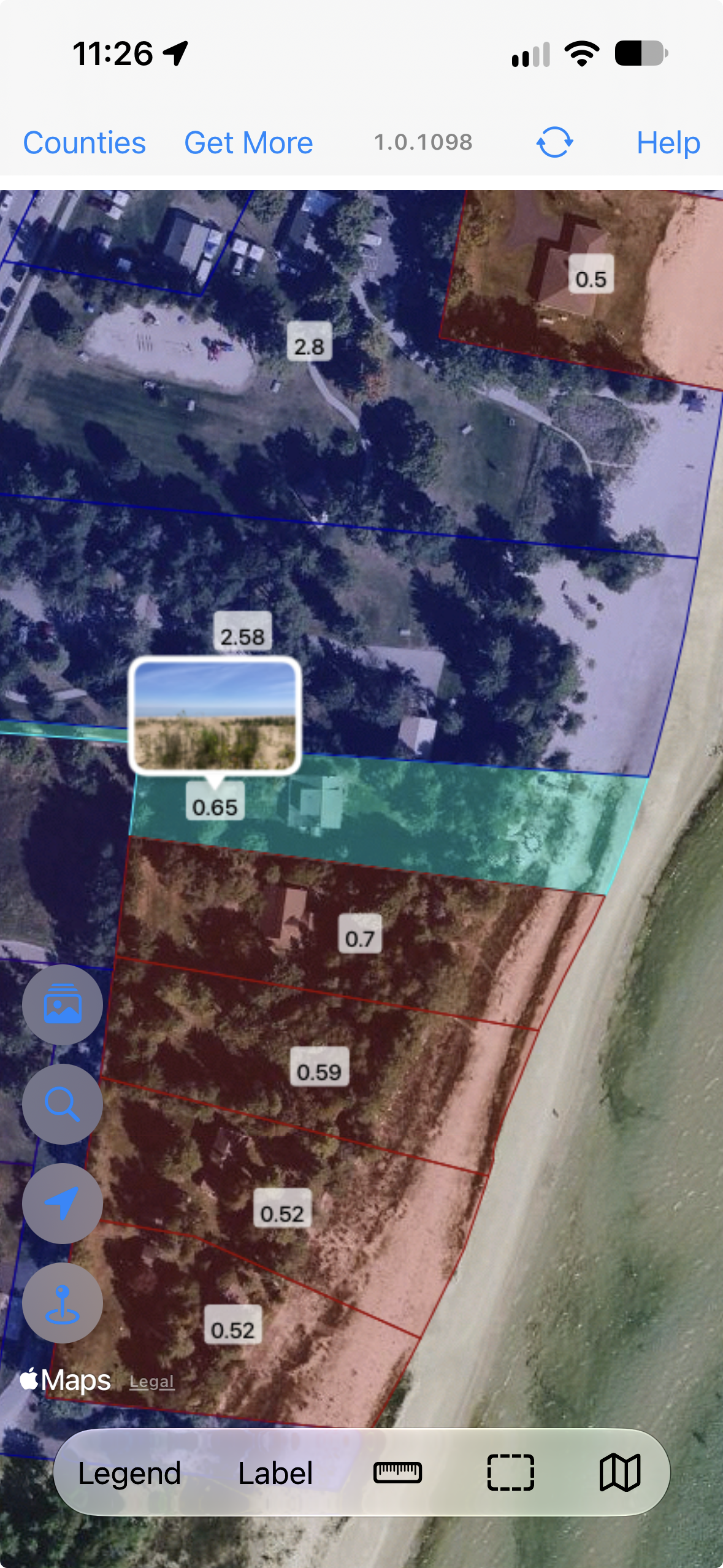
Photos attached to a parcel appear as a picture marker on the map. In the screenshot below, a beach thumbnail marks the selected parcel, giving you a visual reminder of the photos you saved there.
6. Share what you found
Send a PDF report. Create a parcel report in WI 2026 when you want to send the details to a friend, client, or coworker. They can read the PDF without installing WI 2026. Review the report before sending it so you’re comfortable sharing the property information and personal notes it includes.
Share between WI 2026 devices. Use Parcel Notes Sync to copy notes, photos, and sketches to another device running WI 2026 on the same Wi-Fi network. That lets the other person keep the annotations with the parcel in their own app.
What should I save with a parcel?
- Property visits: photos of the features you want to remember and questions for a follow-up.
- Farm work: a fence observation, a picture of its condition, and a sketch marking the area.
- Places you enjoy: photos from a visit and a note about what made the place memorable.
Before your next trip, use our county download guide to bring the parcel records you need. Add your own observations as you go, or organize your photos afterward.