Japan's Land Registry Map on Your iPhone & iPad
In Japan, land is registered by lot number (地番), not by address. Where a town uses the residential address system (住居表示), your address and your lot number are different numbers, and the Legal Affairs Bureau (法務局) asks for the lot number when you request a registry certificate or a copy of the registry map.
The Ministry of Justice publishes its registry maps as free open data on the G-Spatial Information Center (G空間情報センター). GoGIS downloads a town's map and puts every lot, with its number, on your iPhone or iPad. Stand on the land, tap the lot, read its number.
What you can do with it in GoGIS
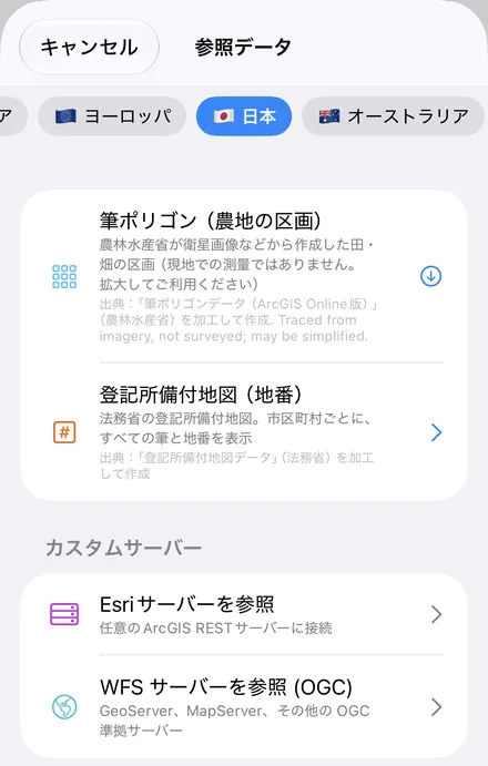
Download the data oncePick the layers you need from Reference Data. They stay on your phone and work with no signal.

Tap the map, even with no signalRead everything the publisher records about the parcel, field or area under your finger.

Photos, sketches and notesTake a picture where you stand, sketch on the map, and write down what you saw.

Your photos on the mapSee every photo where you took it, and share a PDF report of the place and your notes.
How to use it
- Open Reference Data. Tap Import, then Reference Data. With the map in Japan, the Japan datasets appear: tap Registry Map — Lot Numbers (登記所備付地図).
- Choose a town. The town at the map centre comes first. Search the 2,094 towns (one per municipality and registry office) by name, prefecture or reading, in kana or in romaji: "amimachi" or "tokyo" both work. Each row shows the registry office, the release year, the download size and the share of lots that can be placed.
- Tap a lot. Lots are labelled with their numbers and colored by map class. Tap one for its lot number, ōaza, chōme, koaza, accuracy class and map class. With the app in Japanese the columns use the registry's own names; in any other language they are in English.
Lots without a map position
Every map sheet in the data records its coordinate system. Sheets in one of the 19 plane rectangular zones (公共座標1系–19系) have real positions, and GoGIS draws their lots exactly. Sheets in arbitrary local coordinates (任意座標系), mostly the older map-equivalent drawings (地図に準ずる図面, the kōzu), only know where lots are relative to each other, not where the sheet is on Earth. That is a property of the data, not of the app: nobody can draw those lots in the right place.
Across Japan, 46.9% of the 245,140,381 lots in the data are on sheets with real coordinates (all 2,094 towns, counted by GoGIS on 7 November 2026). The share runs from 97.8% in Okinawa and 90.2% in Hokkaido down to 10.0% in Tokyo and 6.3% in Osaka.
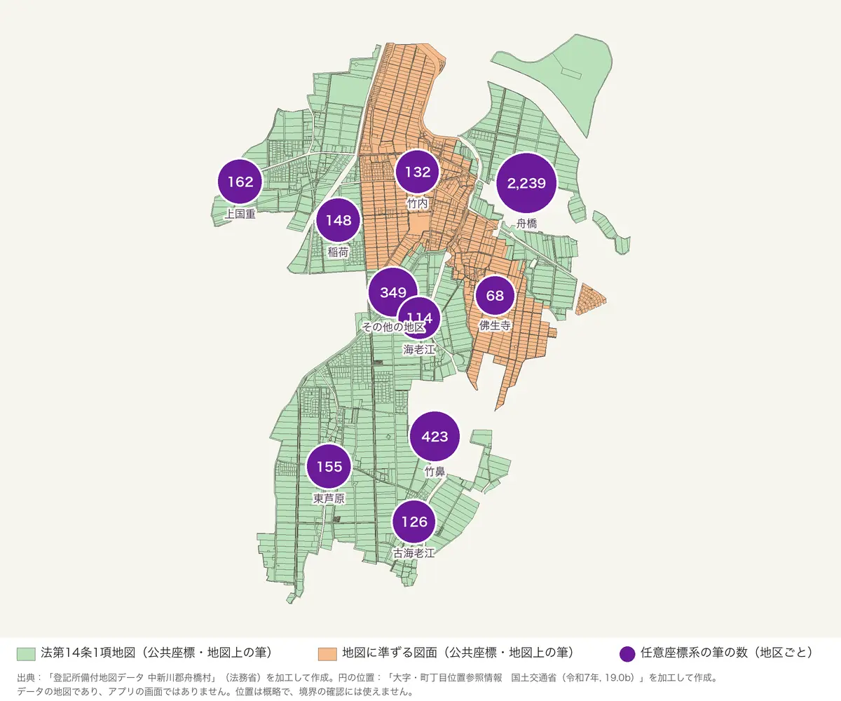
GoGIS keeps every one of those lots:
- A numbered circle per district. Lots without a position are counted by district (大字・丁目) and shown as a purple circle near the district: at the district's point from MLIT's district location data (大字・町丁目位置参照情報), else at the centre of the district's placed lots, else together with the unnamed districts at the town's centre.
- Every lot of a district, listed. Tap a circle and the attribute grid lists all of the district's lots, on the map or not. In a lot's info (ⓘ), Show District does the same; the layer's menu has Districts, every district with its lot count. In that table you can search, filter by ōaza or koaza, sort by lot number, and export the lots as a CSV that Excel opens; see the attribute table on iPhone and iPad.
- Find Lot. In the layer's menu, type a lot number as written on the deed, such as 589-1 or 589番1. It searches every lot of the town, placed or not, and only the exact number matches. The map search finds lot numbers too. A lot on the map is selected and zoomed to; a lot without a position takes you to its district's circle and tells you its district.
Check your town before downloading: the coverage table (in Japanese) lists every town with the share of its lots that have real coordinates, by prefecture, with a search box. Type the town's name in kanji or kana.
Questions
Is the lot number the same as the address?
No. The lot number is the registry's number for a parcel of land; the address is for mail and residence. Where a town uses the residential address system (住居表示), the two are entirely different numbers. To request a registry certificate or a copy of the registry map at the Legal Affairs Bureau, you need the lot number.
Can the registry map settle a boundary?
No. Use it to find land and see its rough shape and neighbours. The registry map itself may not match the ground, especially the older map-equivalent drawings (公図). For boundaries, sales or inheritance, get current documents from the Legal Affairs Bureau and ask a qualified land surveyor (土地家屋調査士).
Why are some lots not drawn on the map?
Their map sheets are in arbitrary local coordinates (任意座標系), which are not tied to any real position, so no app can draw them in the right place. GoGIS keeps them: they are counted by district and shown as a numbered circle near the district, and Find Lot still finds their number and district.
Does it work offline?
Yes. A downloaded town is stored on your iPhone or iPad: the lots, the district circles, the district lists and Find Lot all work without a connection. Save the basemap for offline use too before you go.
Is this the same as the fude polygons?
No. Fude polygons are MAFF's outlines of farm fields traced from imagery; they have nothing to do with registered lots or lot numbers.
Source: 「登記所備付地図データ」(法務省)を加工して作成, from the G-Spatial Information Center; free to use, commercial use included, with this credit. District points: 「大字・町丁目位置参照情報」(国土交通省).
Your lot number, on the spot
Pick a town, download it, and every lot and its number is on your iPhone or iPad.
Get GoGIS on the App Store Get GoGIS on Google Play