Find Your Township, Range and Section on a Map, Offline
Mineral deeds, oil and gas leases, royalty statements and the original land patents rarely give an address. They name a piece of the Public Land Survey System: a principal meridian, a township and range, a section, and often a quarter-quarter or a numbered lot. Here is one, as the Bureau of Land Management printed it in a 2014 North Dakota lease sale notice:
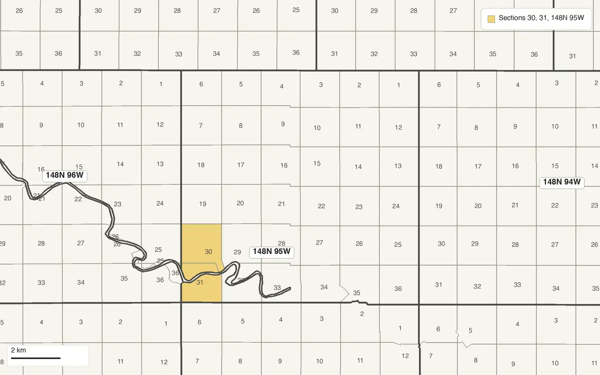
T. 148 N, R. 95 W, 5TH PM, ND SEC. 30 POR LOT 6; SEC. 31 LOTS 14,15; DUNN COUNTY 44.68 AC
That's township 148 north, range 95 west of the Fifth Principal Meridian, and in it part of lot 6 in section 30 and lots 14 and 15 in section 31. Oklahoma documents write the same thing the other way round, section first: SW¼SW¼SW¼ 15-7S-1W is a corner of section 15, township 7 south, range 1 west, east of the Indian Meridian.
What you can do with it in GoGIS
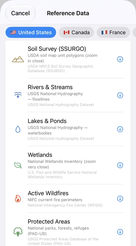
Download the data oncePick the layers you need from Reference Data. They stay on your phone and work with no signal.

Tap the map, even with no signalRead everything the publisher records about the parcel, field or area under your finger.

Photos, sketches and notesTake a picture where you stand, sketch on the map, and write down what you saw.

Your photos on the mapSee every photo where you took it, and share a PDF report of the place and your notes.
How GoGIS Finds It
GoGIS downloads the BLM's survey grid, CadNSDI, straight onto the map: PLSS Townships labeled like a deed (148N 95W), PLSS Sections by number, and PLSS Quarter-Quarters & Lots by part (SWNE, L 6), with their recorded acres where the BLM has them.
- Move the map to the county the document names. Search for a town there, or pan and zoom.
- Open Reference Data: tap Import, then Reference Data, and choose PLSS Townships, then PLSS Sections.
- Find the township's label and the section's number. Zoom in and add PLSS Quarter-Quarters & Lots for the parts and lots.
- Or stand on it. Out on the land, your GPS position on the map tells you which section and quarter-quarter you're in, with no signal once the layers are downloaded.
Next step: open the quarter-quarters' attribute table to search for a part such as SWNE or a lot, total the recorded acres of the ones you filtered with a column summary, and export the list to Excel as a CSV. See the attribute table on iPhone and iPad.
In North Dakota, GoGIS's statewide parcels also carry each parcel's legal description, so you can lay today's property lines over the old survey.
Which Meridian?
A township number means nothing without its meridian. North Dakota is surveyed from the Fifth Principal Meridian, adopted in 1815, which also governs Arkansas, Iowa, Minnesota, Missouri and South Dakota. Oklahoma has two: the Indian Meridian, adopted in 1870, for everything but the panhandle, and the Cimarron Meridian, established in 1881, for the panhandle. Montana, Wyoming, Utah, Idaho and the other western states each have their own; the state public land pages name them.
Then Look It Up: GLO Records, Wells and Leases
- The BLM's General Land Office Records hold more than five million federal land title records issued since 1788, the original patents among them, plus survey plats and field notes going back to 1810. Search them by land description: state, meridian, township, range and section.
- North Dakota wells: the Department of Mineral Resources' Oil and Gas Division has a well search by section, township and range, and a GIS map server.
- Oklahoma wells: the Corporation Commission's Well Data Finder searches by legal location, among other things.
On public land? The same grid, with BLM land, national forest and state trust land, is on the public land pages for Montana, Wyoming, Utah, Idaho, New Mexico, Arizona, Nevada, Colorado, Oregon, California and Washington. And BLM mining claims come from the same survey.
Questions
How do I find the township, range and section I'm standing in?
Download PLSS Townships and PLSS Sections for the area in GoGIS, then tap the map under your GPS position. Once the layers are downloaded, it works with no signal.
Is there a township, range and section finder that works offline?
Yes. Download PLSS Townships and PLSS Sections, and Quarter-Quarters if you need them, for the area while you have a signal. After that GoGIS shows the grid, its labels and your GPS position with no signal, so you can read off the township, range and section in the field.
Can I find the land a lease or deed describes?
Yes. Read off the meridian, township, range and section, move the map to the county, download the grid, and find the township's label and the section's number. Quarter-quarters and government lots, the next level down, are their own layer.
Which states use township and range?
The 30 public-land survey states, from Ohio, Alabama and Florida west to the Pacific, and Alaska. North Dakota is surveyed from the Fifth Principal Meridian; Oklahoma from the Indian Meridian, with the Cimarron Meridian for the panhandle. Texas and the original colonies weren't surveyed this way.
Are the lines legal boundaries?
No. The BLM says of this grid that it's neither a legal document nor a land survey. It's good for reading a description and finding roughly where the land lies; for a boundary on the ground, the survey monuments and a licensed surveyor have the last word.
Does GoGIS show my wells or my lease?
No. It shows the land the description names. Wells, permits and production are in the state's records: in North Dakota, the Oil and Gas Division's well search and map; in Oklahoma, the Corporation Commission's Well Data Finder. Both search by section, township and range.
Every section, in your pocket
Townships, sections and quarter-quarters from the BLM, ready to download on your iPhone or iPad.
Get GoGIS on the App Store Get GoGIS on Google Play