Snap it. Sketch it. Note it.
Add pictures, draw a sketch, and jot down what you saw. Come back to the parcel and pick up where you left off.
How to add photos, sketches & notes → WI 2026WISCONSIN PARCEL MAP
Get WI 2026
WI 2026WISCONSIN PARCEL MAP
Get WI 2026
FOR THE LAND YOU CARE ABOUT
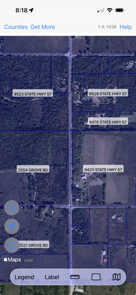
Who owns it? How big is it? What’s it assessed at? Explore Wisconsin’s public parcel map right from your phone.
99¢ once. No subscription.
Available now for iPhone, iPad and Android
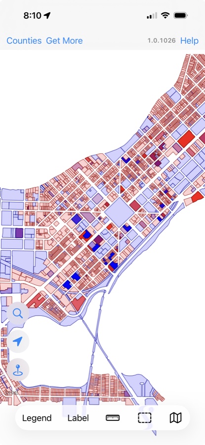
72 counties. One statewide parcel map.
A name. An address. A place to start.
Your photos & notes. On the parcel.
LESS DIGGING. MORE DISCOVERING.
Start with a place you know. Or a place you want to know better. WI 2026 makes it easy to see what’s there.
Choose a step to see it in the app
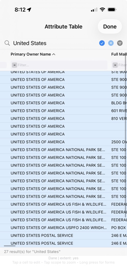
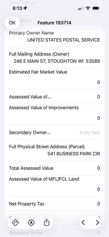
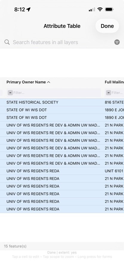
FIND THE ONES THAT FIT
Put parcel records side by side in a familiar table. Sort the columns and filter the results to focus on the properties that matter to you.
It’s called the attribute grid. Think of it as your way to turn a long list of land into a closer look.
A lot to explore for 99¢THE MAP IS JUST THE START
The fence that needs fixing. The spot worth remembering. The property your client needs to see. Keep it all with the parcel.
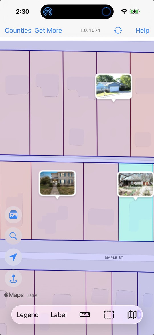
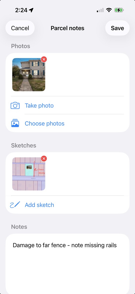
Add pictures, draw a sketch, and jot down what you saw. Come back to the parcel and pick up where you left off.
How to add photos, sketches & notes →Share parcel notes, photos, and sketches with friends or coworkers using WI 2026 on the same Wi-Fi network.
Create a parcel report to send to a client, a friend, or anyone who needs the details. An easy way to share what you found.
YOUR LAND. YOUR REASON.
No mapping background needed. Just a question about a piece of Wisconsin.
Get to know a property before the showing. Keep photos and notes together, then send a parcel report to your client.
Look up public parcel records, compare them in the table, and keep observations attached to the place.
Look up a landowner before asking permission. Keep notes and pictures of places you want to remember.
See neighboring parcels, photograph a fence, or sketch a field observation. Keep the details where they belong.
Or simply curious about the land down the road? This is for you, too.
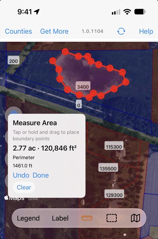
HOW BIG IS IT, REALLY?
Tap your way around the edge of whatever you’re looking at—a pond, a field, a stand of timber, the corner you’re thinking about fencing. WI 2026 gives you the area in acres and square feet, and the distance around it.
Hold and drag to follow a curve. Undo a point that landed in the wrong spot. It works on the counties you’ve already downloaded, so you can find out while you’re standing there—signal or not.
A LITTLE HELP GETTING STARTED
Practical guides to finding parcels, bringing your maps, and keeping photos and notes together.
Go from a street address to the parcel record, and understand what the owner information tells you.
Read the guide →Choose counties, check storage, and prepare before you lose cell service.
Read the guide →Add pictures from a visit, sketch what matters, and share the details with someone else.
Read the guide →Yes. WI 2026 is 99¢ as a one-time app purchase, with no subscription.
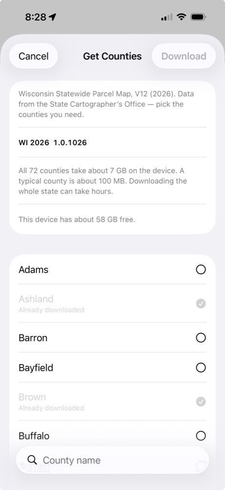
Yes. Choose any of Wisconsin’s 72 counties, or download them all. A typical county is about 100 MB; the entire state is about 7 GB, so you’ll need enough space on your device. Keep the app open while downloads finish.
Yes. Search one county or all the counties you’ve downloaded. Download the whole state to search statewide. Look up owner names, addresses, parcel IDs, and more. Some counties redact owner names, including Kenosha.
County parcel data is stored on your device after you download it. Download counties before heading out. Background maps and aerial imagery may still need an internet connection, and so does the LIVE County Record link—it opens the county’s live website.
Create a PDF parcel report to send to someone else. To copy parcel notes, photos, and sketches between devices running WI 2026, use Parcel Notes Sync while both devices are on the same Wi-Fi network.
WI 2026 uses Wisconsin’s public Statewide Parcel Map V12 (2026), from the Wisconsin State Cartographer’s Office. Tax-roll information can be older than the map release. Want up-to-date information? Tap LIVE County Record and WI 2026 opens that parcel on the county’s own website—the live record, in 70 of Wisconsin’s 72 counties. About the source data ↗
Your searches, downloaded county data, and parcel notes stay on your device and are not sent to GoGIS. You decide when to share your notes or reports. Background map and location services have their own platform details; see our privacy policy.
WI 2026 is an independent GoGIS app, not an official State of Wisconsin app or a legal survey. Parcel records are view-only; your notes don’t change the public record. A parcel map does not grant permission to enter land.
A LITTLE CURIOSITY GOES A LONG WAY
Parcel maps, property details, photos, sketches, and reports.
Just 99¢, one time. No subscription.
Available for iPhone and iPad as Wisconsin Parcels 2026 on the App Store.