Related Forms for Mobile GIS Field Records
Most GIS attribute tables are one row per feature. That works for static facts like asset ID, pipe size, owner, or parcel number. Field work is different. A feature may need a new inspection every month, several maintenance events over its life, multiple photos, or a long series of readings.
Related Forms solve that problem in GoGIS. Instead of forcing every new field visit into the main layer attributes, you attach additional forms to the layer and fill them out as many times as needed for each feature. The GIS feature stays clean, while the repeated activity history stays organized and linked.
What Related Forms Are
A Related Form is an additional form definition attached to a layer. When you select a feature in that layer, GoGIS can show the main feature attributes plus any related form entries already collected for that feature.
- One feature, many records. Fill out the same form repeatedly for the same asset or location.
- Multiple activities per layer. Attach different forms for inspections, readings, service calls, or samples.
- Time-ordered history. Each completed entry is timestamped so you can review what happened and when.
- Same rich field types. Related Forms can use text, numbers, pick lists, ratings, photos, signatures, sketches, dates, barcodes, and more.
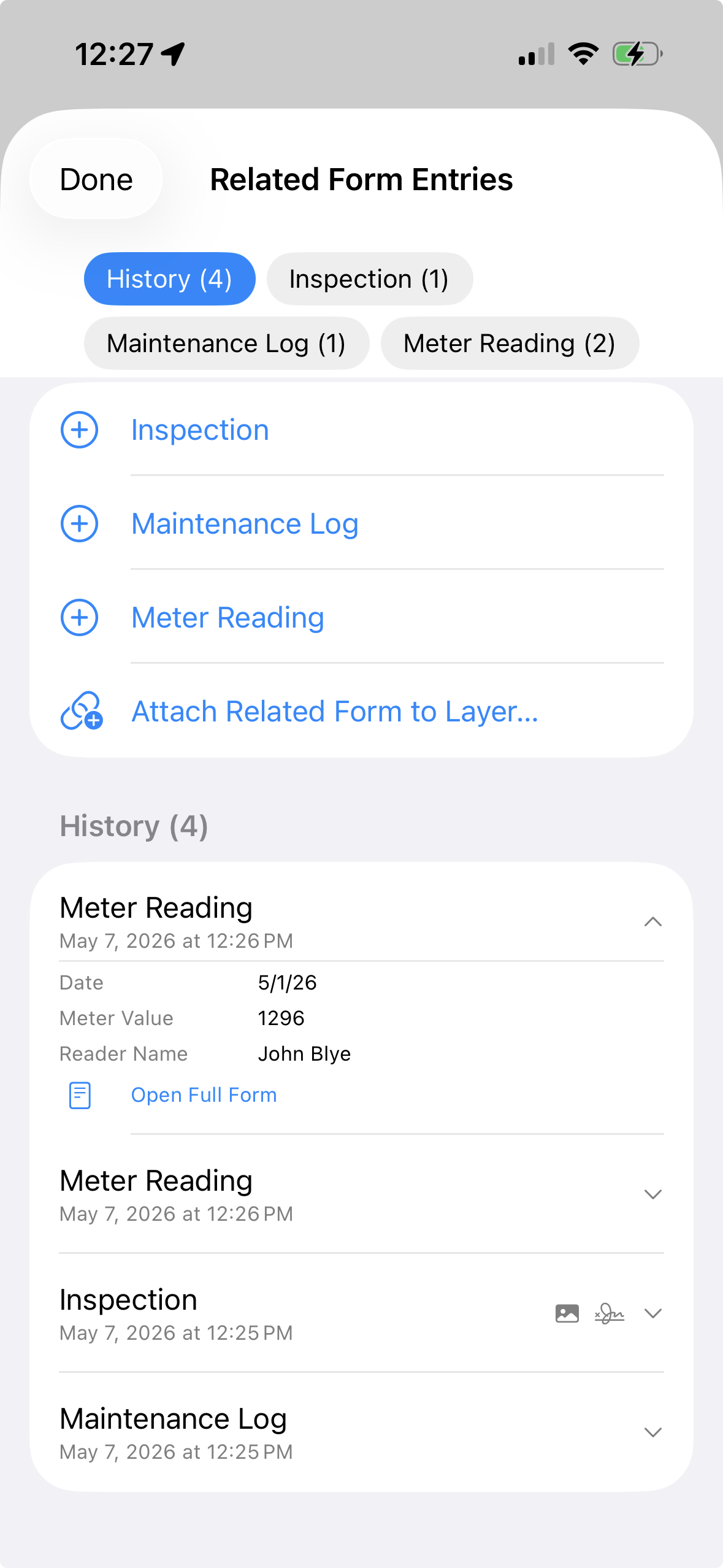
A Utility Meter Example
Imagine a meter layer imported from a shapefile. Each meter feature already has stable attributes like asset number, service area, installation date, and location. Those belong in the main layer. But field activity belongs in Related Forms.
Inspection
Use an inspection form for condition, access, visible damage, photo evidence, signature, and notes. A meter may have one inspection this year and several more in future years.
Maintenance Log
Use a maintenance form for work performed, parts replaced, technician name, follow-up needed, and photos. This creates a service history without adding dozens of maintenance columns to the main meter layer.
Meter Reading
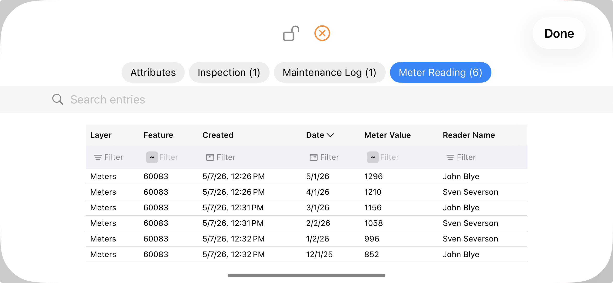
Use a meter reading form for reading date, value, reader name, and comments. The same meter can collect a series of readings over time, then show those records in a grid.
Other Workflows That Fit
- Environmental monitoring: repeated site visits, water quality readings, photo logs, and corrective actions.
- Agriculture: multiple soil samples, scouting observations, treatment records, and follow-up checks tied to the same field or sample point.
- Infrastructure: valve inspections, hydrant flushing, pole condition checks, meter readings, and maintenance activity.
- Property management: site inspections, tenant requests, photo documentation, and repair history tied to parcels or buildings.
How It Works in GoGIS
Design Related Forms with the same form builder used for feature attributes. Attach one or more forms to a layer. Then, when you interact with a feature, you can review old entries, open a full entry, add a new entry, or attach another form to the layer if the workflow changes.
This keeps field collection flexible. You can start with a simple meter reading form, then later add a maintenance log or inspection form without rebuilding the whole layer.
Export
Related Forms export as CSV files alongside the normal GIS export. The main feature layer can still export as Shapefile, GeoJSON, KML, GeoPackage, or CSV. Related form entries travel in parallel CSV files and include a GoGIS_ID column that links each related record back to the parent GIS feature.
Need to understand the export structure?
The linking guide explains how Related Form CSV files connect back to the main GIS layer.
Read the Linking Guide