WISCONSIN PARCEL GUIDES
How to find who owns hunting land in Wisconsin
Download the county, tap the parcel, and read the owner’s name and mailing address from the tax roll. To see public land and open forest land on the same map, color it by Auxiliary Class of Property. WI 2026 does both on iPhone, iPad, or Android, with no signal once the county is on your phone.
A name is not permission. On private land that isn’t enrolled as open to the public, you need the owner’s permission to hunt. Follow the DNR’s hunting regulations, which outrank anything on this page.
1. Find out who owns the land
In WI 2026, open Get More to reach Get Counties, then download the county you’ll hunt, plus any neighbor if you’ll be near the line. Do this before you leave cell service. Our offline download guide covers storage.
Use Go To Location to jump to your GPS position or a set of coordinates, then tap the parcel. Look for Primary Owner Name and Full Mailing Address (Owner). The mailing address is often the useful one, because the owner of a woodlot may live somewhere else.
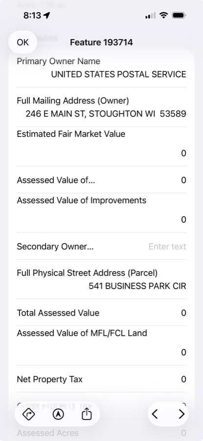
Some counties withhold names from the statewide data. The biggest gaps are in Kenosha (5.1% of parcels carry a name) and Dane (88.6% of parcels carry a name). Where a name is missing, ask the county. The owner can also be a company, a trust, or a public body, and the record is a tax-roll snapshot rather than a live feed, so a recent sale may not show yet.
2. Ask early and be specific
Give the owner time, say when you’d like to hunt and which land you mean, and take no for an answer. Keep what they tell you with the parcel: add a note or a photo in WI 2026 so the boundary they showed you and the place they asked you to park are there when you come back. Those notes stay on your device.
3. See public land and open forest land
Tap Legend, then choose Auxiliary Class of Property. Every county you’ve downloaded is colored by its tax-roll class. Tap any parcel to see its class spelled out.
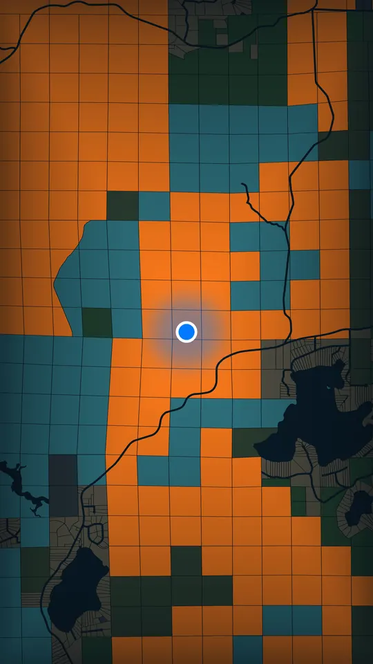
| Code | Class | What to do |
|---|---|---|
| W5, W7 | Managed Forest Law, open | The DNR says this land allows hunting, fishing, hiking, sightseeing and cross-country skiing. Confirm it on the DNR’s map first. |
| W6, W8 | Managed Forest Law, closed | Treat as private. Ask the owner. |
| W1, W2, W3 | Forest cropland | The DNR says open Forest Crop Law land allows public hunting and fishing. Confirm it on the DNR’s map first. |
| X1, X2, X3, W4 | Federal, state, county, county forest crop land | Government-owned, which doesn’t always mean open. A parcel could be a wildlife area or a county garage, and the tax roll doesn’t say which. Check with the agency that manages it. |
| X4 | Other exempt | Don’t assume access. Ask the owner. |
| No forest or exempt code | Most private land | Ask the owner. |
4. Know the rules on open forest land
From the DNR’s hunting questions and access questions on open Managed Forest Law and Forest Crop Law land:
- Access is on foot only.
- Tree stands are allowed but can’t damage trees or the land, and can’t stay overnight without the landowner’s permission.
- If the owner has marked an access route, you must follow it.
- Crop fields aren’t covered. You need the landowner’s permission to enter one, even to retrieve a deer.
- If you’re sure you’re on the correct property and find “No Trespassing” signs or are asked to leave, the DNR says to report it to a local tax law forestry specialist or a warden. If you’re denied access, it also lists 1-888-936-7463.
5. What the map can’t tell you
WI 2026 shows the tax roll. It doesn’t show posted areas, access routes, or current DNR listings, and the property lines you see are parcel lines from county records: a reference, not a survey. A parcel that’s only partly enrolled carries the class across the whole parcel on the map.
The DNR’s list and map of private forest land open to the public is the place to confirm open land before you go. Tribal trust land is also not open to public access, and the DNR warns that plat books usually label it “USA” or “USA trust”, so don’t assume land owned by “USA” is a national forest.
How the 72 counties compare
Across Wisconsin, the tax roll marks about 6.3 million acres as government-owned or county forest crop land, about 924,000 acres as open Managed Forest Law land, and about 3,038,000 acres as closed. Oneida County has the most open Managed Forest Law land, 118,529 acres, and Bayfield County has the most government-owned land, 496,814 acres. No land is listed as open in 9 counties.
Tap a column heading to sort, or a county for its parcel map and records.
| County | Government-owned | Open MFL | Closed MFL |
|---|---|---|---|
| Oneida | 219,027 | 118,529 | 83,100 |
| Sawyer | 360,855 | 80,479 | 38,974 |
| Forest | 398,828 | 80,201 | 41,503 |
| Douglas | 352,494 | 75,384 | 25,446 |
| Price | 270,636 | 62,971 | 94,324 |
| Lincoln | 119,089 | 60,551 | 111,479 |
| Iron | 298,760 | 60,507 | 11,258 |
| Ashland | 302,006 | 50,757 | 32,428 |
| Florence | 141,931 | 47,418 | 32,481 |
| Rusk | 110,631 | 40,044 | 53,835 |
| Langlade | 181,821 | 39,955 | 90,272 |
| Bayfield | 496,814 | 35,773 | 34,148 |
| Marinette | 269,185 | 25,460 | 114,009 |
| Washburn | 165,256 | 18,851 | 54,233 |
| Adams | 24,005 | 17,558 | 81,983 |
| Taylor | 154,762 | 13,985 | 61,226 |
| Vilas | 243,825 | 13,786 | 22,132 |
| Marathon | 68,671 | 9,255 | 121,635 |
| Jackson | 206,660 | 7,246 | 60,334 |
| Dunn | 24,958 | 5,970 | 68,582 |
| Wood | 76,205 | 5,561 | 53,883 |
| Clark | 140,683 | 5,042 | 70,993 |
| Eau Claire | 57,995 | 4,505 | 34,570 |
| Burnett | 175,600 | 4,341 | 28,594 |
| Juneau | 123,698 | 4,099 | 57,114 |
| Oconto | 190,901 | 3,965 | 61,133 |
| Barron | 27,731 | 3,405 | 45,212 |
| Polk | 47,962 | 3,351 | 52,875 |
| Chippewa | 53,025 | 3,168 | 29,617 |
| Crawford | 35,602 | 2,473 | 62,084 |
| Door | 18,129 | 1,986 | 18,295 |
| Vernon | 20,931 | 1,882 | 93,274 |
| Monroe | 95,032 | 1,697 | 64,854 |
| Grant | 27,637 | 1,466 | 31,820 |
| St Croix | 22,543 | 1,409 | 18,081 |
| Trempealeau | 15,030 | 1,264 | 78,643 |
| Pierce | 8,456 | 1,171 | 39,242 |
| Shawano | 38,640 | 1,093 | 109,706 |
| Waushara | 21,432 | 1,062 | 50,175 |
| Portage | 42,179 | 1,011 | 63,089 |
| Sauk | 38,492 | 819 | 68,254 |
| Pepin | 5,600 | 812 | 27,565 |
| Iowa | 25,137 | 506 | 66,056 |
| Richland | 10,869 | 455 | 93,253 |
| Manitowoc | 11,430 | 386 | 17,944 |
| Green | 7,839 | 307 | 10,051 |
| Sheboygan | 36,586 | 302 | 7,757 |
| Marquette | 15,908 | 292 | 29,531 |
| La Crosse | 37,146 | 286 | 48,378 |
| Lafayette | 7,893 | 268 | 10,707 |
| Brown | 15,394 | 243 | 3,990 |
| Walworth | 18,257 | 222 | 3,176 |
| Waupaca | 14,468 | 212 | 98,751 |
| Rock | 14,432 | 163 | 3,375 |
| Columbia | 30,507 | 138 | 29,453 |
| Ozaukee | 7,919 | 119 | 1,135 |
| Buffalo | 29,147 | 100 | 127,891 |
| Outagamie | 26,215 | 43 | 25,009 |
| Washington | 17,080 | 40 | 5,001 |
| Dodge | 50,432 | 36 | 3,964 |
| Dane | 41,048 | 34 | 24,218 |
| Kewaunee | 4,181 | 20 | 10,055 |
| Calumet | 12,365 | 16 | 4,259 |
| Fond du Lac | 34,351 | 0 | 5,036 |
| Green Lake | 19,646 | 0 | 3,910 |
| Jefferson | 25,281 | 0 | 4,527 |
| Kenosha | 11,580 | 0 | 1,132 |
| Menominee | 3,452 | 0 | 833 |
| Milwaukee | 17,263 | 0 | 0 |
| Racine | 8,091 | 0 | 1,434 |
| Waukesha | 30,435 | 0 | 2,125 |
| Winnebago | 24,132 | 0 | 2,166 |
These are whole-parcel mapped acres from the V12 statewide parcel data, built from county tax rolls, mostly 2025. Each parcel counts once per column, but a parcel with both open and closed land counts in both. A partly enrolled parcel counts in full, so treat these as a way to compare counties, not as acres you can hunt. Government-owned includes land that isn’t open to hunting.
Parcel data is the Wisconsin Statewide Parcel Map Database (V12), a public-domain product of the Wisconsin Land Information Program and the State Cartographer’s Office, UW–Madison. WI 2026 is an independent app, not a government app or an official record of ownership.