Austria's INVEKOS Fields & Soil Map on Your iPhone & iPad
Every field an Austrian farmer declares to the Agrarmarkt Austria (AMA) for CAP payments is a Schlag in INVEKOS, the integrated administration and control system, and the AMA publishes them with their crops each year. The BFW, the federal research centre for forests, publishes the digital soil map of Austria's farmland (eBOD). Both are open data under CC BY 4.0, on the agriculture ministry's open API.
GoGIS now has an Austria section in Reference Data. Move the map to your area, pick a dataset, and it downloads as a layer on your iPhone or iPad: with German column names when the app is in German, English otherwise.
What you can do with it in GoGIS
Download the data oncePick the layers you need from Reference Data. They stay on your phone and work with no signal.

Tap the map, even with no signalRead everything the publisher records about the parcel, field or area under your finger.

Photos, sketches and notesTake a picture where you stand, sketch on the map, and write down what you saw.

Your photos on the mapSee every photo where you took it, and share a PDF report of the place and your notes.
The Three Austrian Datasets
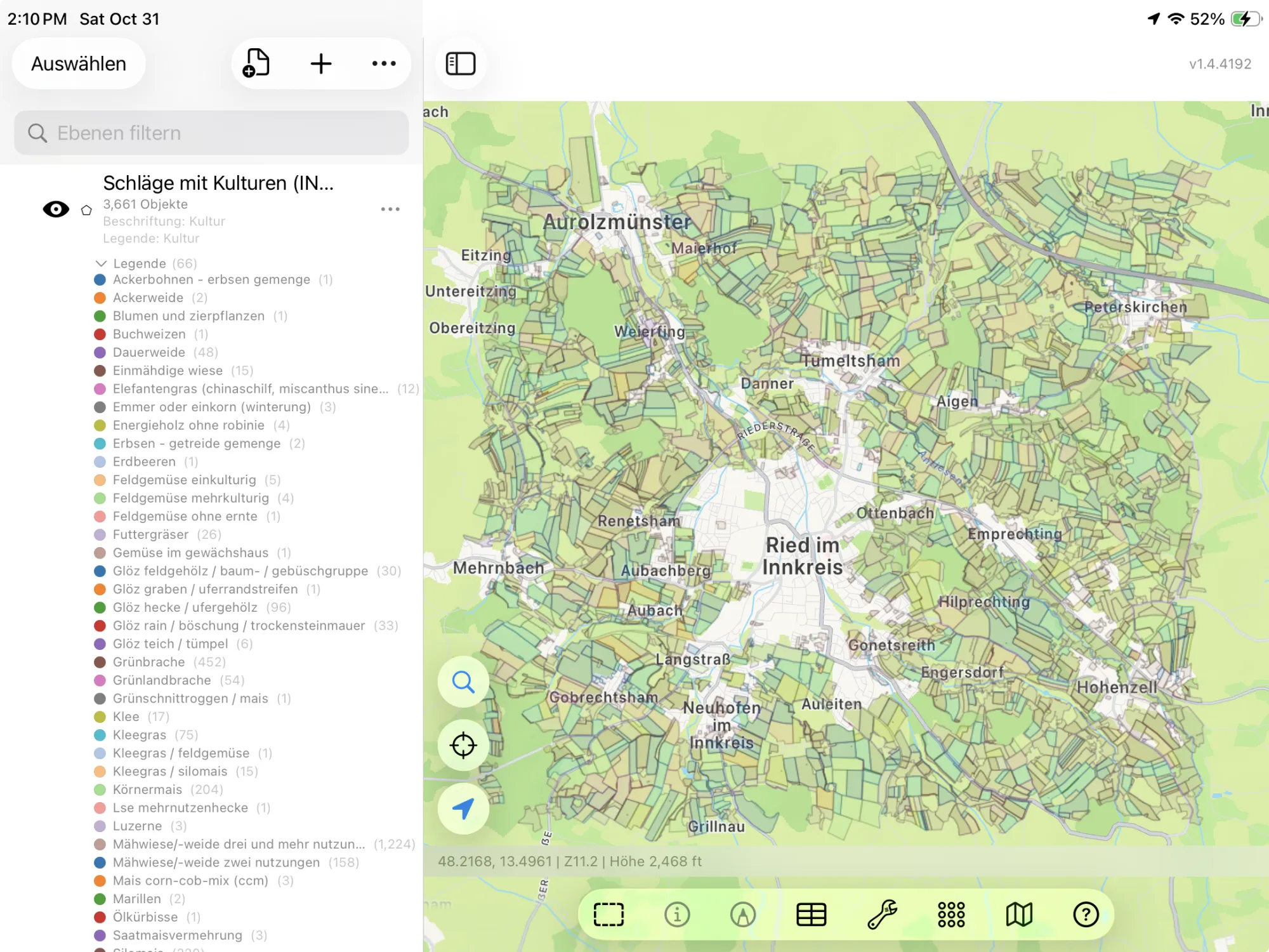
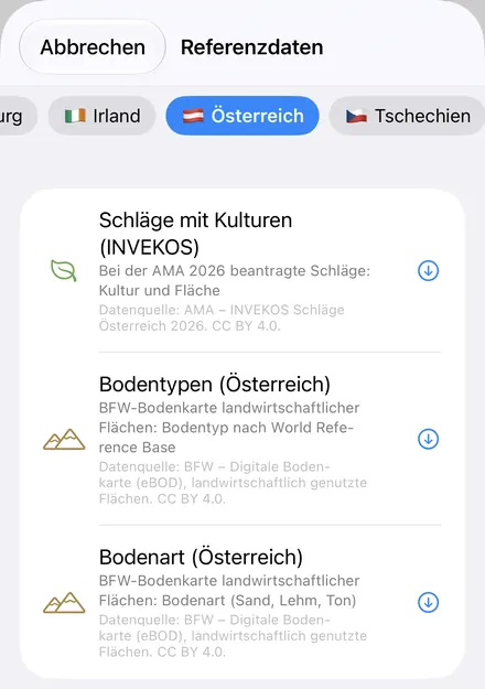
- Austria Crop Fields (INVEKOS) — the field parcels declared to the AMA in 2026, as they stood in summer: each field's crop as the AMA names it (Körnermais, Winterweichweizen, Wintergerste, Sojabohnen), its crop code and its area in hectares. No farmers' names. The layer arrives colored and labeled by crop. Datenquelle: AMA – INVEKOS Schläge Österreich 2026. CC BY 4.0.
- Austria Soil Types — the BFW's soil map of farmland, with each soil's full name in the World Reference Base (Stagnic Cambisol (Humic), Eutric Gleysol (Fluvic)) and its reference soil group (Cambisol, Gleysol). The layer arrives colored by reference soil group. Datenquelle: BFW – Digitale Bodenkarte (eBOD), landwirtschaftlich genutzte Flächen. CC BY 4.0.
- Austria Soil Texture — the same map by topsoil texture class, in the FAO's classes (Loam, Clay loam). The layer arrives colored by texture. Datenquelle: BFW – Digitale Bodenkarte (eBOD), landwirtschaftlich genutzte Flächen. CC BY 4.0.
German or English
With GoGIS in German, the columns are Kultur, Kulturcode and Fläche (ha) for the fields, Bodentyp (WRB) and Referenzbodengruppe for the soil types, and Bodenart (FAO) for the texture. In any other language they're Crop, Crop Code, Area (ha), Soil Type (WRB), Reference Soil Group and Soil Texture (FAO). The values are the publishers' own: crops in German, as the AMA writes them (GoGIS turns the AMA's capitals into ordinary case, WINTERWEICHWEIZEN into Winterweichweizen), and the soil classes in the international terms the BFW uses.
How to Download the Layers
- Move the map to your area. Search for a town or an address, or pan and zoom to the land you want. GoGIS downloads what's on the screen.
- Open Reference Data. Tap Import, then Reference Data. The row of countries along the top opens on the one the map is showing, so with the map in Austria, the Austria datasets are the ones listed.
- Choose a dataset. The download keeps going if you switch apps or the screen would otherwise lock, and progress shows on the map. The ministry's server counts what's in the area first; if there are a great many features, GoGIS tells you how many and asks before it downloads them.
- Read the map. Fields arrive colored and labeled by crop, soils colored by soil group or texture. Tap anything to see everything about it.
Put the Layers to Work
- Add up the crops. In the fields' attribute table, filter Crop to Körnermais or any other crop and total Area (ha) with a column summary, or export the filtered fields as a CSV that Excel opens. Step by step: the attribute table on iPhone and iPad.
- See what's grown around you. The fields show this year's rotation at a glance: maize, wheat, barley, soya and grassland, field by field.
- Read the soil under a field. Tap a field's ground for its WRB soil type and texture class before you sample, plant or plan drainage.
- Combine them with your own data. Use Intersect to cut the fields by soil type and see how much of each field is loam or clay, or lay your own sample points over them.
- Export or print. Share any layer as a Shapefile, GeoPackage, KML, GeoJSON or CSV, or print a PDF map. The AMA's and the BFW's credits go on the print and with the export.
Elsewhere in Europe? Reference Data also has the German cadastre and crop fields, the cadastral parcels of Czechia, Slovenia and four more countries, Belgium's crop parcels, cadastre and soil map, and OpenStreetMap roads, rivers, buildings and land use anywhere.
Questions
Does GoGIS include Austria's cadastre?
No. The BEV's digital cadastral map (DKM) isn't open data; it's licensed for a fee, so GoGIS can't download it for you. The INVEKOS fields and the BFW soil map are open, so they're included.
Does the soil map cover all of Austria?
It covers farmland. The BFW's eBOD maps the land in agricultural use, so forests, high mountains and towns have no soil polygons.
Do the fields show who farms them?
No. The AMA publishes each field's crop and area, nothing about the farmer.
Which year are the fields?
2026, as the declared fields stood in summer. The crop is the one declared for that year.
Do I need desktop GIS software, an account or an API key?
No. GoGIS downloads from the agriculture ministry's open service. There's no key, no account and nothing to unzip.
Austria's fields and soils, in your pocket
The AMA's INVEKOS fields and the BFW's soil map, in German or English, ready to download on your iPhone or iPad.
Get GoGIS on the App Store Get GoGIS on Google Play