German Cadastre & Crop Fields on Your iPhone & iPad
Germany has no national parcel map. Each of the sixteen states (Länder) runs its own cadastre, and each state's agriculture ministry publishes the fields farmers declare for CAP payments (InVeKoS) on its own terms. They're all on different servers, in different coordinate grids, with different column names: flstnrzae and flstnrnen in one state, zae and nen in the next, a crop written as Code 115: Winterweichweizen here and 115 - Winterweizen there.
GoGIS now has a Germany section in Reference Data that does that work for you. Move the map to your area, pick a dataset, and GoGIS asks each state whose land is on the screen, converts what comes back, and gives you one layer in the same plain columns wherever you are.
The Two German Datasets
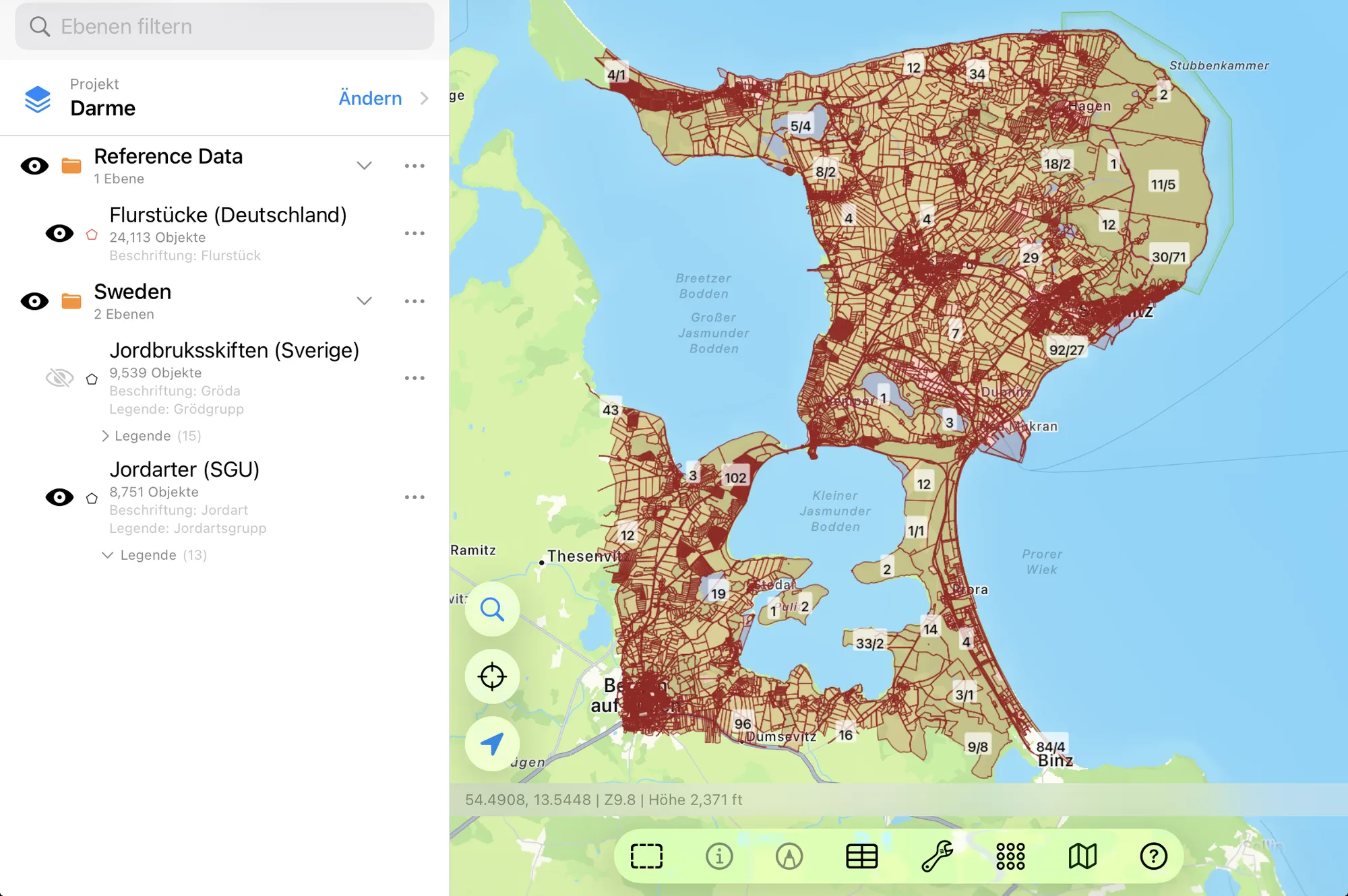
- Germany Cadastral Parcels — the ALKIS cadastre, every state but Bavaria. Each parcel (Flurstück) is written the way German maps write it, numerator and denominator (123/4), with its Flur, cadastral district (Gemarkung), municipality, official area in hectares, location (street and house number, where it has one), parcel ID (Flurstückskennzeichen) and state. Parcels are small, so zoom in to a village or a few farms before you download. ALKIS, from each state's survey office (GeoBasis-DE). Each state's own source note goes with the layer.
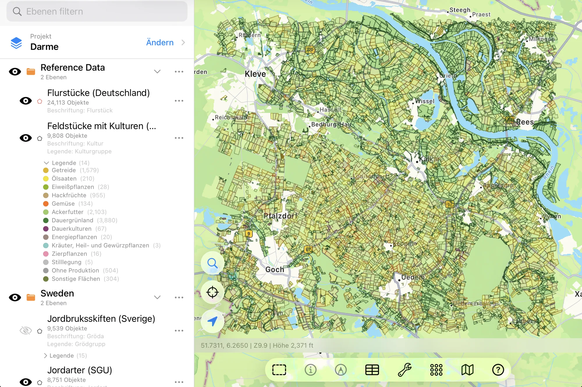
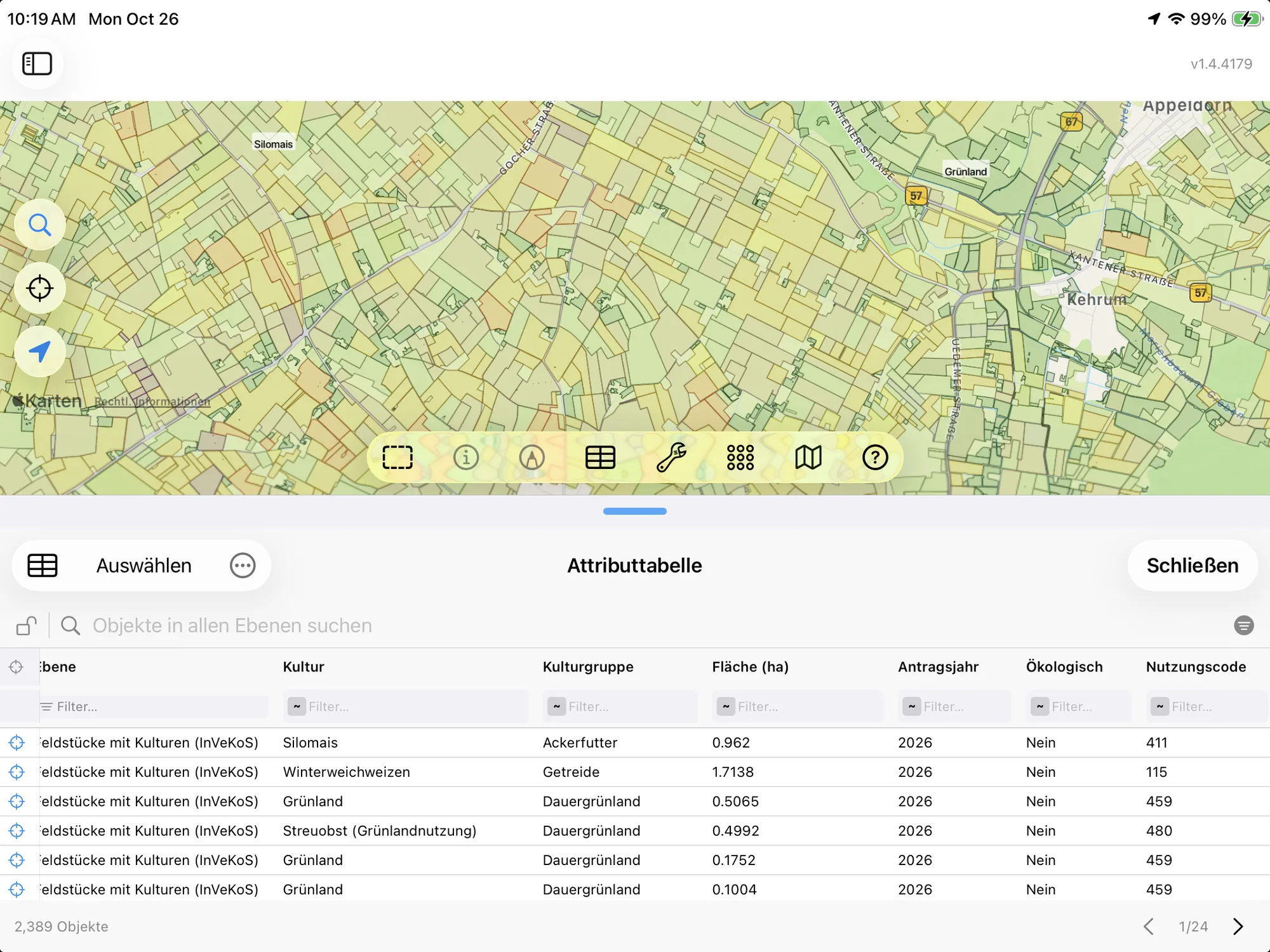
- Germany Crop Fields (InVeKoS) — the fields declared for CAP payments, with the crop, crop group, area, year, organic status and national crop code (Nutzungscode). Bavaria, Baden-Württemberg, North Rhine-Westphalia and Brandenburg publish the crop itself; Schleswig-Holstein and Saarland publish the crop group only. The layer arrives colored by crop group, and you can download a wider area than the cadastre. InVeKoS, from each state's agriculture ministry. Each state's own source note goes with the layer.
Every State, One Layer
A map area on a state line gets both sides. GoGIS asks every state whose land the screen touches, puts each answer into the same columns, and adds a State column so you always know whose data a parcel is. A state server that's down for maintenance doesn't spoil the rest: you get the parcels from the states that answered.
What each state publishes openly:
| State | Cadastre | Crop fields |
|---|---|---|
| Baden-Württemberg | Yes | Crop |
| Bavaria | — (login only) | Crop |
| Berlin | Yes | — |
| Brandenburg | Yes | Crop |
| Bremen | Yes | — |
| Hamburg | Yes | — |
| Hesse | Yes | — |
| Lower Saxony | Yes | — |
| Mecklenburg-Western Pomerania | Yes | — |
| North Rhine-Westphalia | Yes | Crop |
| Rhineland-Palatinate | Yes | — |
| Saarland | Yes | Crop group |
| Saxony | Yes | — |
| Saxony-Anhalt | Yes | — |
| Schleswig-Holstein | Yes | Crop group |
| Thuringia | Yes | — |
Where the Data Comes From
The parcels are each state's Liegenschaftskataster, from its open ALKIS service (most states publish the AdV's simplified schema, ALKIS vereinfacht): LGL Baden-Württemberg, Geoportal Berlin, LGB Brandenburg, Landesamt GeoInformation Bremen, LGV Hamburg, HVBG Hesse, LGLN Lower Saxony, GeoBasis-DE/M-V, Geobasis NRW, LVermGeo Rhineland-Palatinate, LVGL Saarland, GeoSN Saxony, LVermGeo Saxony-Anhalt, LVermGeo Schleswig-Holstein and GDI-Th Thuringia.
The crop fields are the states' published InVeKoS data, the geospatial aid application (GSAA): the fields in each farmer's application (Antragsflächen, Schläge) with their crop type (Kulturart). They come from FIONA in Baden-Württemberg, the Bavarian agriculture ministry's InVeKoS service, the Landwirtschaftskammer NRW, Brandenburg's agriculture ministry, and the INSPIRE land-use services of Schleswig-Holstein and Saarland. The field blocks (Feldblöcke) that several states publish say nothing about the crop, so they aren't included.
In English or in German
This is German data, so GoGIS speaks German when you do. With the app set to German, the parcel columns are Flurstück, Flur, Gemarkung, Gemeinde, Fläche (ha), Lage, Kennzeichen and Bundesland, and each crop keeps the name its own state gives it (Winterweizen, Silomais, Wiesen). In any other language you get English throughout: Parcel, Cadastral District, Municipality, Area (ha), and Winter wheat, Silage corn, Meadows, translated from the national crop code.
The columns, the values and the legend all change together, so a printed map or an exported shapefile reads in one language from end to end. The crop code stays in its own column, so you can always match a field back to the official list.
The Crop Groups
The legend uses the crop groups of the German IACS code list, colored roughly as the crops look from the air. Tap a field for its exact crop, or change the legend to color by crop, organic status or any other column.
| Crop group | In German |
|---|---|
| Cereals | Getreide |
| Oilseeds | Ölsaaten |
| Protein crops | Eiweißpflanzen |
| Root crops | Hackfrüchte |
| Vegetables | Gemüse |
| Arable forage | Ackerfutter |
| Permanent grassland | Dauergrünland |
| Permanent crops | Dauerkulturen |
| Energy crops | Energiepflanzen |
| Other industrial crops | Andere Handelsgewächse |
| Herbs and medicinal plants | Kräuter, Heil- und Gewürzpflanzen |
| Ornamental plants | Zierpflanzen |
| Set-aside | Stilllegung |
| Out of production | Ohne Produktion |
| Other land | Sonstige Flächen |
How to Download the Parcels
- Move the map to your area. Search for a town or an address, or pan and zoom to the fields you want. GoGIS downloads what's on the screen.
- Open Reference Data. Tap Import, then Reference Data. The row of countries along the top opens on the one the map is showing, so with the map in Germany, the Germany datasets are the ones listed. Tap another country, or Global for worldwide data such as OpenStreetMap.
- Choose a dataset. The download keeps going if you switch apps or the screen would otherwise lock, and progress shows on the map. If an area holds a great many parcels, GoGIS tells you how many and asks before it downloads them.
- Read the map. The crop fields arrive colored by crop group and labeled by crop; the cadastre arrives labeled by parcel number. Tap any parcel to see everything about it.
Put the Parcels to Work
- Find a parcel on the ground. Walk to it with your GPS position on the map and the parcel numbers on screen, with or without signal once the layer is downloaded.
- See what's grown around you. In the states that publish crops, the fields show this year's rotation at a glance: where the wheat, rapeseed, corn and grassland are, and which neighbours farm organically.
- Combine them with your own data. Open your field boundaries or sample points over them, or use Intersect to cut the crop fields by the cadastre and see which crops sit on which parcels.
- Export or print. Share either layer as a Shapefile, GeoPackage, KML, GeoJSON or CSV, or print a PDF map. Each state's source note goes on the print and with the export.
Elsewhere in Europe? Reference Data also has the Dutch cadastre and crop parcels, Swedish crop fields and soil maps, the French cadastre and crop parcels, and OpenStreetMap roads, rivers, buildings and land use anywhere.
Questions
Why is Bavaria missing from the cadastre?
Bavaria publishes its parcels only behind a login, so GoGIS can't download them. Its crop fields are open, so Bavaria is in the crop fields dataset.
Why do some states have no crop fields?
Not every state publishes its declared fields with the crop. Several publish only the field blocks, without saying what's grown, and some publish nothing open at all. GoGIS includes every state that publishes crops or crop groups openly.
Does the cadastre show legal boundaries?
ALKIS is the official register's map, and it's what everyone uses to find a parcel, but for a boundary on the ground the survey records (and a surveyor) have the last word.
Do I need desktop GIS software or an account?
No. GoGIS downloads the parcels straight from each state's open service. There's no key, no account and nothing to unzip.
Germany's parcels, in your pocket
ALKIS parcels and declared crop fields, in English or German, ready to download on your iPhone or iPad.
Get GoGIS on the App Store