Poland's Cadastral Parcels, Crops & Forests on Your iPhone & iPad
Poland's land data is spread over three agencies. The Head Office of Geodesy and Cartography (GUGiK) gathers every powiat's land register service into one nationwide cadastral parcel service, refreshed daily. The Agency for Restructuring and Modernisation of Agriculture (ARiMR) publishes the crop fields farmers declare in their payment applications. And the State Forests' Forest Data Bank (Bank Danych o Lasach, BDL) publishes the forest stands of every forest district.
GoGIS now has a Poland section in Reference Data with all three. Move the map to your area, pick a dataset, and it downloads as a layer on your iPhone, iPad or Android phone, to read, search, combine with your own data and take into the field without a signal.
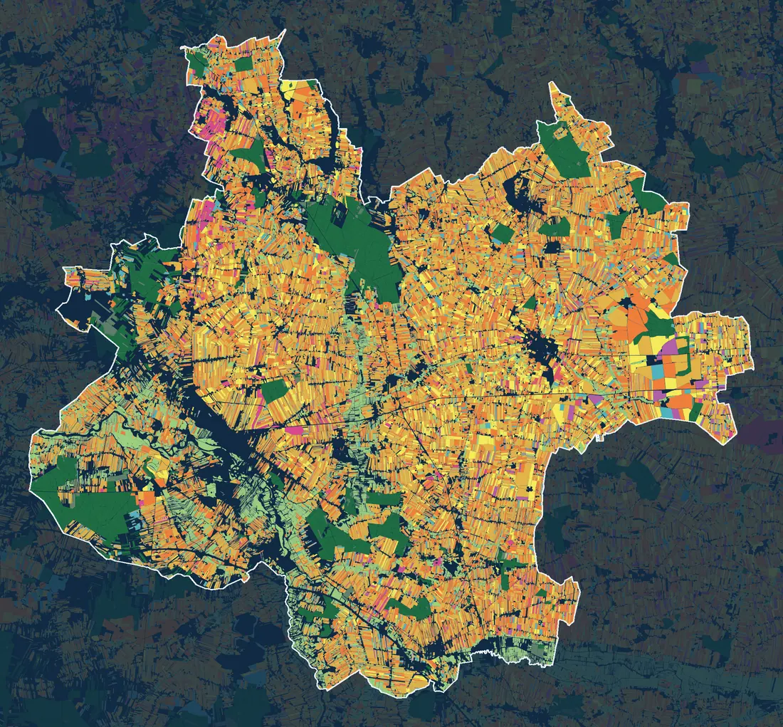
- Cereals
- Oilseeds
- Root crops
- Vegetables
- Legumes
- Fodder crops, maize included
- Grassland
- Orchards and permanent crops
- State Forests stands
Every powiat has its own page, in Polish, with a map like this one and its numbers: cadastral parcels, declared crop area by crop group, the most common crops and the share of forest stands. See Mapy powiatów: działki, uprawy i lasy.
What you can do with it in GoGIS
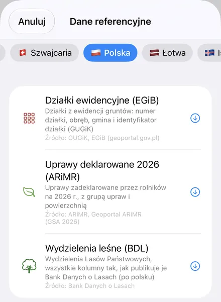
Download the data oncePick the layers you need from Reference Data. They stay on your phone and work with no signal.

Tap the map, even with no signalRead everything the publisher records about the parcel, field or area under your finger.

Photos, sketches and notesTake a picture where you stand, sketch on the map, and write down what you saw.

Your photos on the mapSee every photo where you took it, and share a PDF report of the place and your notes.
The Three Polish Datasets
- Cadastral Parcels (EGiB) (Działki ewidencyjne) — every parcel GUGiK's consolidated land register service holds for the map area, with its parcel number, precinct (obręb), commune (gmina) and full parcel ID, such as 306401_1.0039.79. GoGIS measures each parcel's area from its boundary. The free, open part of the register is the parcels' IDs and geometry, and that is all GoGIS takes: no owners, no land-use classes, no registered area. Coverage is what each powiat publishes. Source: Główny Urząd Geodezji i Kartografii – Ewidencja Gruntów i Budynków (zbiorcza usługa WFS, dane powiatowe), geoportal.gov.pl.
- Declared Crops 2026 (ARiMR) (Uprawy deklarowane 2026) — the fields farmers declared in their 2026 payment applications (the geospatial application, GSA): each field's crop as ARiMR names it, its crop group and its declared area. The layer arrives colored by crop group. These are farmers' declarations, not field inspections, and ARiMR updates them monthly. There are no farmers' names or details. Source: ARiMR, Geoportal ARiMR – deklaracje rolne 2026 (GSA).
- Forest Stands (BDL) (Wydzielenia leśne) — the State Forests' forest subcompartments from the forest districts' management plans, with BDL's own columns as BDL publishes them, in Polish: forest address, area type, forest site type, dominant species and its age, area, forest function and protection category. Values keep BDL's codes, such as D-STAN for a stand and SO for Scots pine. The layer covers forests the State Forests manage; private, municipal and national park forests are mostly not in it. Source: Bank Danych o Lasach (www.bdl.lasy.gov.pl), Biuro Urządzania Lasu i Geodezji Leśnej for the Directorate-General of the State Forests.
How to Download the Layers
- Move the map to your area. Search for a town, or pan and zoom to the land you want. GoGIS downloads what's on the screen. Parcels are small, so start with a commune, a precinct or a few farms.
- Open Reference Data. Tap Import, then Reference Data. The row of countries along the top opens on the one the map is showing, so with the map in Poland, the Poland datasets are the ones listed.
- Choose a dataset. When an area holds a great many features, GoGIS tells you how many and asks before it downloads them.
- Read the map. Tap a parcel, field or stand to see everything about it, search for a parcel number, or color a layer by any column.
Put the Layers to Work
- Total the declared area. In the declared crops' attribute table, filter by crop group and sum the declared area with a column summary; search the parcels by parcel ID or filter the stands by dominant species, and export the rows as a CSV for Excel. See the attribute table on iPhone and iPad.
- Find a parcel on the ground, offline. The layers stay on your device, with your GPS position over parcel lines, fields and stands.
- See what's grown around you. The declared crops show this year's crops field by field: winter wheat, triticale, rye, maize, rapeseed, sugar beet and grassland.
- Combine them with your own data. Use Intersect to find which parcels a buffer around a ditch or a road touches, or lay your own sample points and forms over the fields.
- Export or print. Share any layer as a Shapefile, GeoPackage, KML, GeoJSON or CSV, or print a PDF map. Each source's credit goes on the print and with the export.
Elsewhere in Central Europe? Reference Data also has Czechia's cadastral map, Germany's cadastre and crop fields, Lithuania's reference parcels and soil map, and OpenStreetMap roads, rivers, buildings and land use anywhere. Every country is in Reference Data by Country.
Questions
Do the parcels show owners?
No. None of the three layers carries owner data. A cadastral parcel in GoGIS is its identifier, number, precinct, commune and boundary.
Is this an official record?
No. It is for finding your way on the ground. Where a boundary runs is for a licensed surveyor (geodeta) to say, and official cadastral extracts come from the powiat office (starostwo).
Do I need desktop GIS software, an account or an API key?
No. GoGIS downloads from GUGiK's, ARiMR's and the Forest Data Bank's public services. There's no key, no account and nothing to unzip.
Poland's land, in your pocket
Cadastral parcels, declared crops and forest stands, ready to download on your iPhone, iPad or Android phone.
Get GoGIS on the App Store Get GoGIS on Google Play