Lithuania's Reference Parcels & Soil Map on Your iPhone & iPad
The National Paying Agency (Nacionalinė mokėjimo agentūra) keeps Lithuania's Land Parcel Identification System: the reference parcels every farm payment is measured against, each classed by its land cover. The Lithuanian Geological Survey publishes the national soil map. Both are open data under CC BY 4.0, on Lithuania's INSPIRE geoportal.
GoGIS now has a Lithuania section in Reference Data. Move the map to your area, pick a dataset, and it downloads as a layer on your iPhone or iPad, with English column names and the land-cover classes in plain words.
What you can do with it in GoGIS
Download the data oncePick the layers you need from Reference Data. They stay on your phone and work with no signal.

Tap the map, even with no signalRead everything the publisher records about the parcel, field or area under your finger.

Photos, sketches and notesTake a picture where you stand, sketch on the map, and write down what you saw.

Your photos on the mapSee every photo where you took it, and share a PDF report of the place and your notes.
The Two Lithuanian Datasets
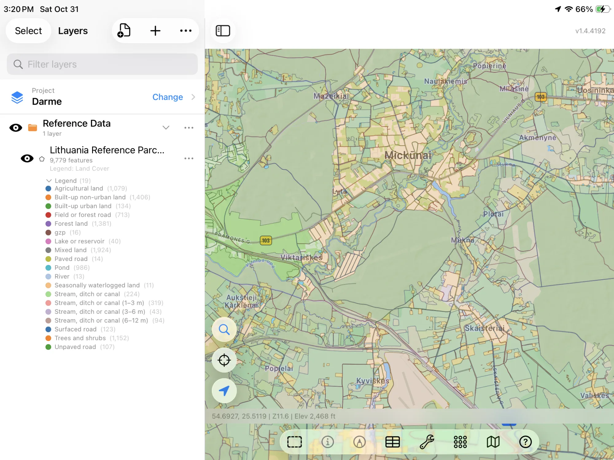
- Lithuania Reference Parcels — the 2026 LPIS reference land parcels: each parcel's land cover in words (Agricultural land, Forest land, Built-up urban land, Seasonally waterlogged land, roads, ditches and ponds), the geoportal's class code beside it (bl1), the parcel's ID and its area in hectares, measured from the outline. The layer arrives colored by land cover. Nacionalinė mokėjimo agentūra – Referencinės žemės sklypai 2026, via INSPIRE geoportal. CC BY 4.0.
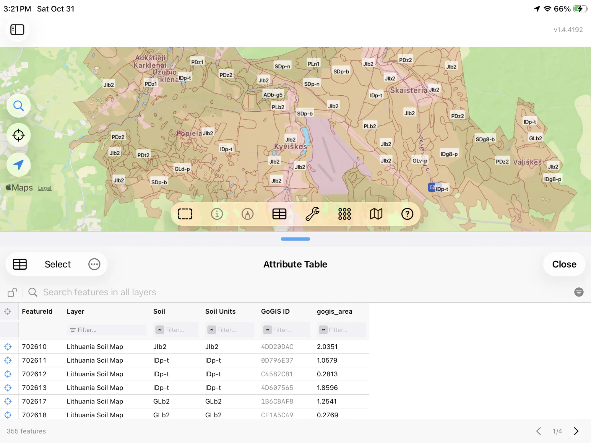
- Lithuania Soil Map — the soil units of the national soil map, labeled in the Lithuanian soil classification (LTDK-99) as the survey writes them (GLb-y, IDg8-p), with the soil units each polygon holds. The layer arrives labeled by soil. Lietuvos geologijos tarnyba – Dirvožemio žemėlapis, via INSPIRE geoportal. CC BY 4.0.
How to Download the Layers
- Move the map to your area. Search for a town or an address, or pan and zoom to the land you want. GoGIS downloads what's on the screen.
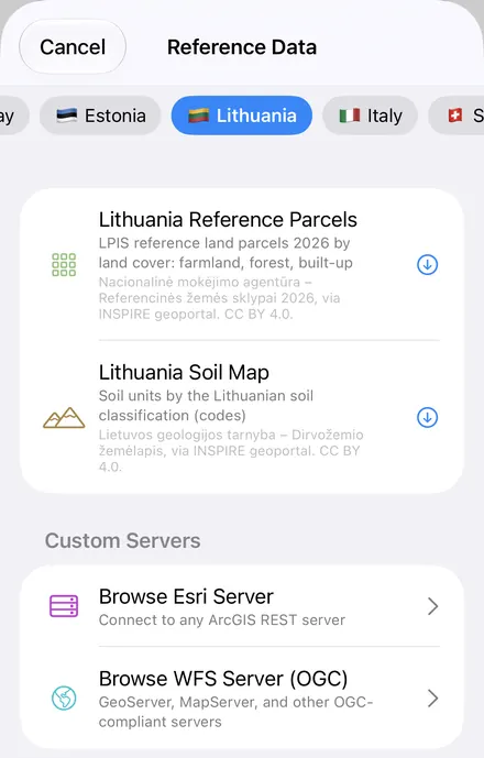
- Open Reference Data. Tap Import, then Reference Data. The row of countries along the top opens on the one the map is showing, so with the map in Lithuania, the Lithuania datasets are the ones listed.
- Choose a dataset. The download keeps going if you switch apps or the screen would otherwise lock, and progress shows on the map. When an area holds a great many features, GoGIS tells you how many and asks before it downloads them.
- Read the map. Reference parcels arrive colored by land cover, soils labeled by their code. Tap anything to see everything about it.
Put the Layers to Work
- Total the farmland. In the reference parcels' attribute table, filter land cover to Agricultural land and sum the hectares with a column summary, or export the filtered parcels as a CSV that Excel opens. See the attribute table on iPhone and iPad.
- See the land cover around you. The reference parcels split the countryside into farmland, forest, built-up land and water, parcel by parcel.
- Read the soil under a field. Tap the soil map for the soil's LTDK-99 code before you sample or plant.
- Combine them with your own data. Use Intersect to cut the reference parcels by soil, or lay your own field boundaries over them.
- Export or print. Share either layer as a Shapefile, GeoPackage, KML, GeoJSON or CSV, or print a PDF map. Each source's credit goes on the print and with the export.
Elsewhere in the Baltics? Reference Data also has Estonia's cadastre, field blocks and crop fields, Finland's crop parcels and cadastre, Sweden's crop fields and soil map, and OpenStreetMap roads, rivers, buildings and land use anywhere.
Questions
Does GoGIS have Lithuania's cadastre?
No. Lithuania's cadastral data is published for non-commercial use only, so GoGIS leaves it out. The reference parcels and the soil map are CC BY 4.0, so they're included.
What are the soil codes?
They're the Lithuanian soil classification, LTDK-99, as the Geological Survey labels its soil map. GoGIS keeps them as published, so they match the survey's own legend.
Do the reference parcels show farmers or crops?
No. A reference parcel is the land itself, classed by its cover; it doesn't say who farms it or what's grown on it this year.
Do I need desktop GIS software, an account or an API key?
No. GoGIS downloads from Lithuania's open INSPIRE geoportal. There's no key, no account and nothing to unzip.
Lithuania's land, in your pocket
The LPIS reference parcels and the national soil map, ready to download on your iPhone or iPad.
Get GoGIS on the App Store Get GoGIS on Google Play