Estonia's Cadastre, Field Blocks & Crop Fields on Your iPhone & iPad
Estonia's land registers are unusually open. The Land and Spatial Development Board (Maa- ja Ruumiamet) publishes every cadastral unit with its address, its designated purpose, its type of ownership and how much of it is arable land, grassland and forest. The Agricultural Registers and Information Board (PRIA) publishes its field blocks and the fields farmers declare each year, with their crops.
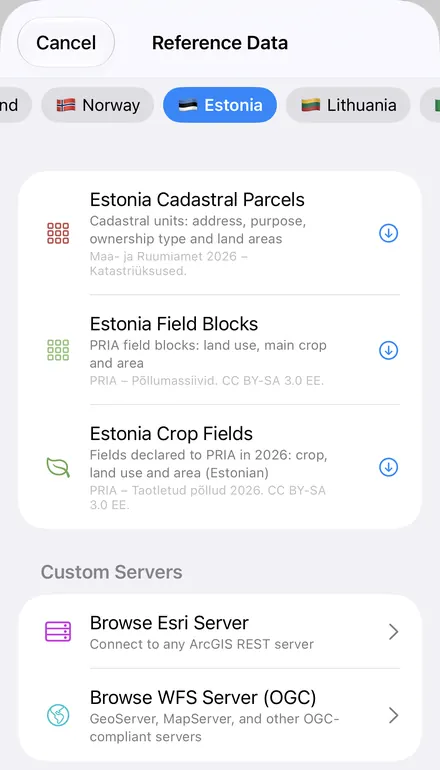
GoGIS now has an Estonia section in Reference Data. Move the map to your area, pick a dataset, and it downloads as a layer on your iPhone or iPad, with English column names and areas in hectares. Crops stay in Estonian, as PRIA writes them.
What you can do with it in GoGIS
Download the data oncePick the layers you need from Reference Data. They stay on your phone and work with no signal.

Tap the map, even with no signalRead everything the publisher records about the parcel, field or area under your finger.

Photos, sketches and notesTake a picture where you stand, sketch on the map, and write down what you saw.

Your photos on the mapSee every photo where you took it, and share a PDF report of the place and your notes.
The Three Estonian Datasets
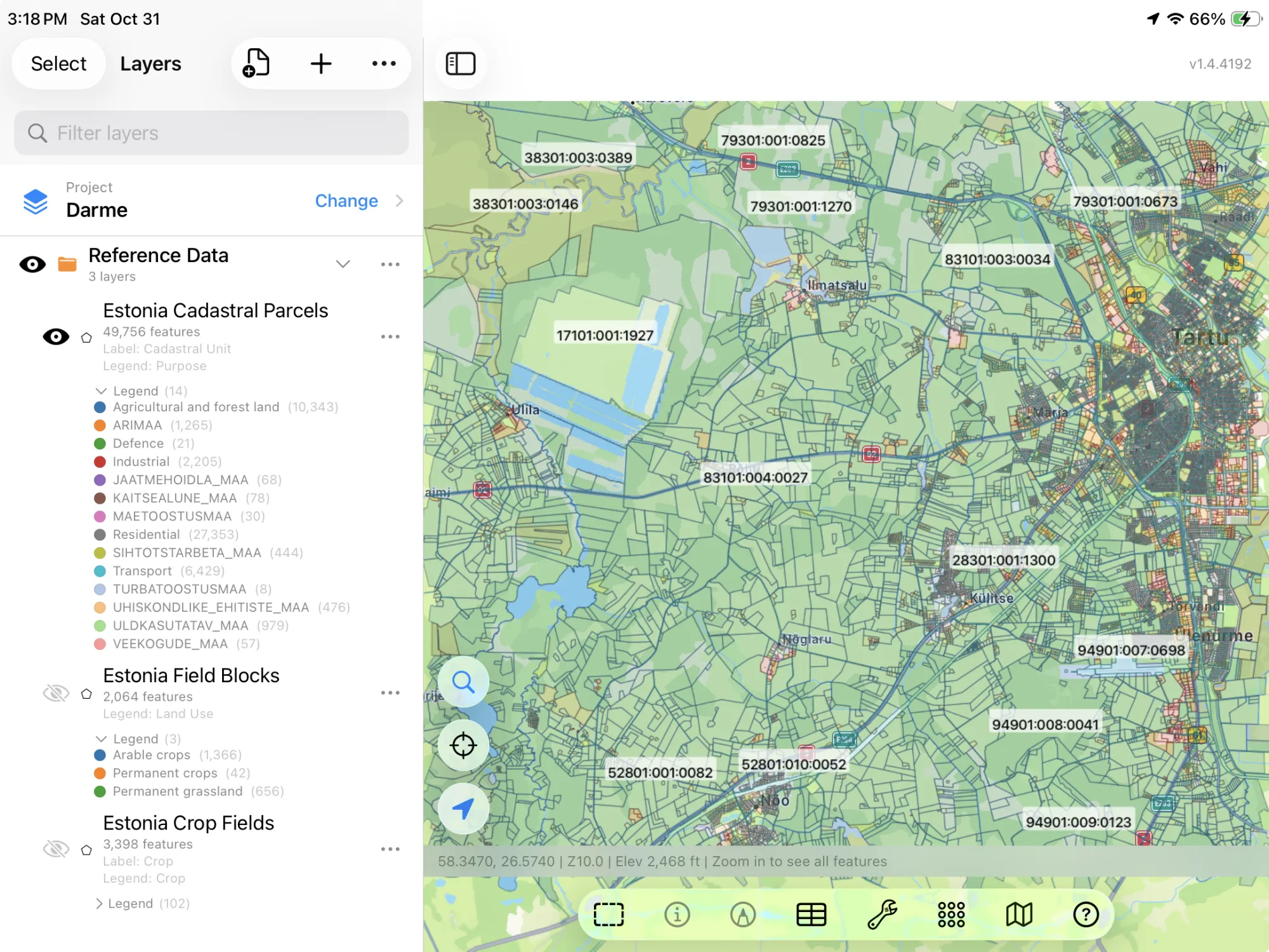
- Estonia Cadastral Parcels — the cadastral units: each unit's code, its address, settlement, municipality and county, its designated purpose (Residential, Commercial, Agricultural and forest land, Protected land), its type of ownership (Private, Municipal, State), its area, and its arable land, grassland and forest in hectares. Ownership is the type only, never an owner's name. The layer arrives colored by purpose and labeled by cadastral code. Maa- ja Ruumiamet 2026 – Katastriüksused.
- Estonia Field Blocks — PRIA's field blocks: each block's ID, its land use (Arable crops, Permanent grassland, Permanent crops), its main crop, its area, municipality and county. The layer arrives colored by land use. PRIA – Põllumassiivid. CC BY-SA 3.0 EE.
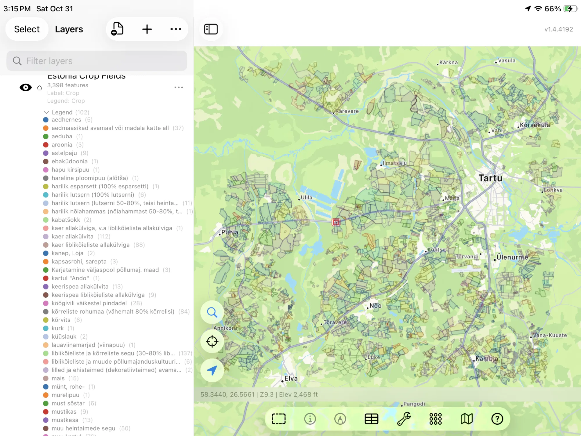
- Estonia Crop Fields — the fields declared to PRIA in 2026: field ID, crop (talinisu allakülvita, kaer allakülvita, rohttaimed), land use (Arable land, Permanent grassland), area and year. The applicant's name and registry code are never asked for. The layer arrives colored and labeled by crop. PRIA – Taotletud põllud 2026. CC BY-SA 3.0 EE.
How to Download the Layers
- Move the map to your area. Search for a town or an address, or pan and zoom to the land you want. GoGIS downloads what's on the screen.
- Open Reference Data. Tap Import, then Reference Data. The row of countries along the top opens on the one the map is showing, so with the map in Estonia, the Estonia datasets are the ones listed.
- Choose a dataset. The download keeps going if you switch apps or the screen would otherwise lock, and progress shows on the map. When an area holds a great many features, GoGIS tells you how many and asks before it downloads them.
- Read the map. The cadastre arrives colored by purpose, field blocks by land use, crop fields by crop. Tap anything to see everything about it.
Put the Layers to Work
- Total the hectares. In the cadastre's attribute table, filter by designated purpose or type of ownership and sum the arable land, grassland or forest hectares with a column summary; the crop fields filter by crop the same way. See the attribute table on iPhone and iPad.
- Size up a property. Tap a cadastral unit for its address, purpose and how many hectares of it are arable, grassland and forest.
- See what's grown around you. The crop fields show this year's crops field by field: winter and spring wheat, oats, barley, rapeseed and grass.
- Combine them with your own data. Use Intersect to cut the crop fields by cadastral unit, or lay your own sample points over the field blocks.
- Export or print. Share any layer as a Shapefile, GeoPackage, KML, GeoJSON or CSV, or print a PDF map. Each source's credit goes on the print and with the export.
Elsewhere in the Baltics and Nordics? Reference Data also has Lithuania's reference parcels and soil map, Finland's crop parcels and cadastre, Sweden's crop fields and soil map, and OpenStreetMap roads, rivers, buildings and land use anywhere.
Questions
Do the layers show owners or farmers?
No. The cadastre says whether a unit is private, municipal or state land, never who owns it, and GoGIS asks PRIA only for the crop fields' crop, land use, area and year, never the applicant's name or registry code.
What does CC BY-SA mean for PRIA's layers?
PRIA's field blocks and crop fields are licensed CC BY-SA 3.0 EE: you can use and share them, with the credit, and anything you make from them and share stays under the same licence. The cadastre allows commercial reuse with the source named.
Why are the crops in Estonian?
Estonian isn't one of the app's languages, so the columns are in English. The crops stay as PRIA writes them, so they read the same as in PRIA's own records.
Do I need desktop GIS software, an account or an API key?
No. GoGIS downloads from the Land and Spatial Development Board's and PRIA's open services. There's no key, no account and nothing to unzip.
Estonia's land, in your pocket
The national cadastre and PRIA's field blocks and crop fields, ready to download on your iPhone or iPad.
Get GoGIS on the App Store Get GoGIS on Google Play