GIS Software for Mac
Many desktop GIS packages don't run natively on a Mac. If you work on one, that can mean keeping a second computer just to open a shapefile.
GoGIS runs on Macs with Apple silicon. It's the iPad app, running on the Mac the way Apple lets iPad apps run there. Same app, same tools, same files. On the Mac, imports open the Mac's own Open panel, and exports open its Save dialog, so files go where you expect.
Before you install: GoGIS needs a Mac with Apple silicon (M1 or later). It doesn't run on Intel Macs. And a Mac has no GPS, so field collection belongs on your iPhone or iPad.
GoGIS on your Mac
On the Mac App Store, search for GoGIS and look under iPhone & iPad Apps.
Get GoGIS on the App StoreOpen Your Files with the Mac's Open Panel
Click Import and GoGIS shows the standard macOS Open panel, with your folders and iCloud Drive. You can pick several files at once. It opens:
- Shapefiles, as the usual ZIP. GoGIS unzips it and reads the .prj, so a projected county or state file lands in the right place.
- GeoPackage, with each table as its own layer.
- KML and KMZ, keeping their colors and line widths as the layer's legend, with the fields in each description table as columns.
- GeoJSON, and CSV with coordinate columns.
- GeoTIFF and MBTiles imagery, such as a drone orthomosaic.
The format guides were written on iPhone and iPad, and everything after the import is the same on the Mac: shapefiles, GeoPackage, KML and KMZ, and large files.
Work on Them at Your Desk
A big screen is a good place for the parts of a GIS job that aren't fieldwork:
- Review a file someone sent you: click a feature to see its attributes, color the layer by a column, label it.
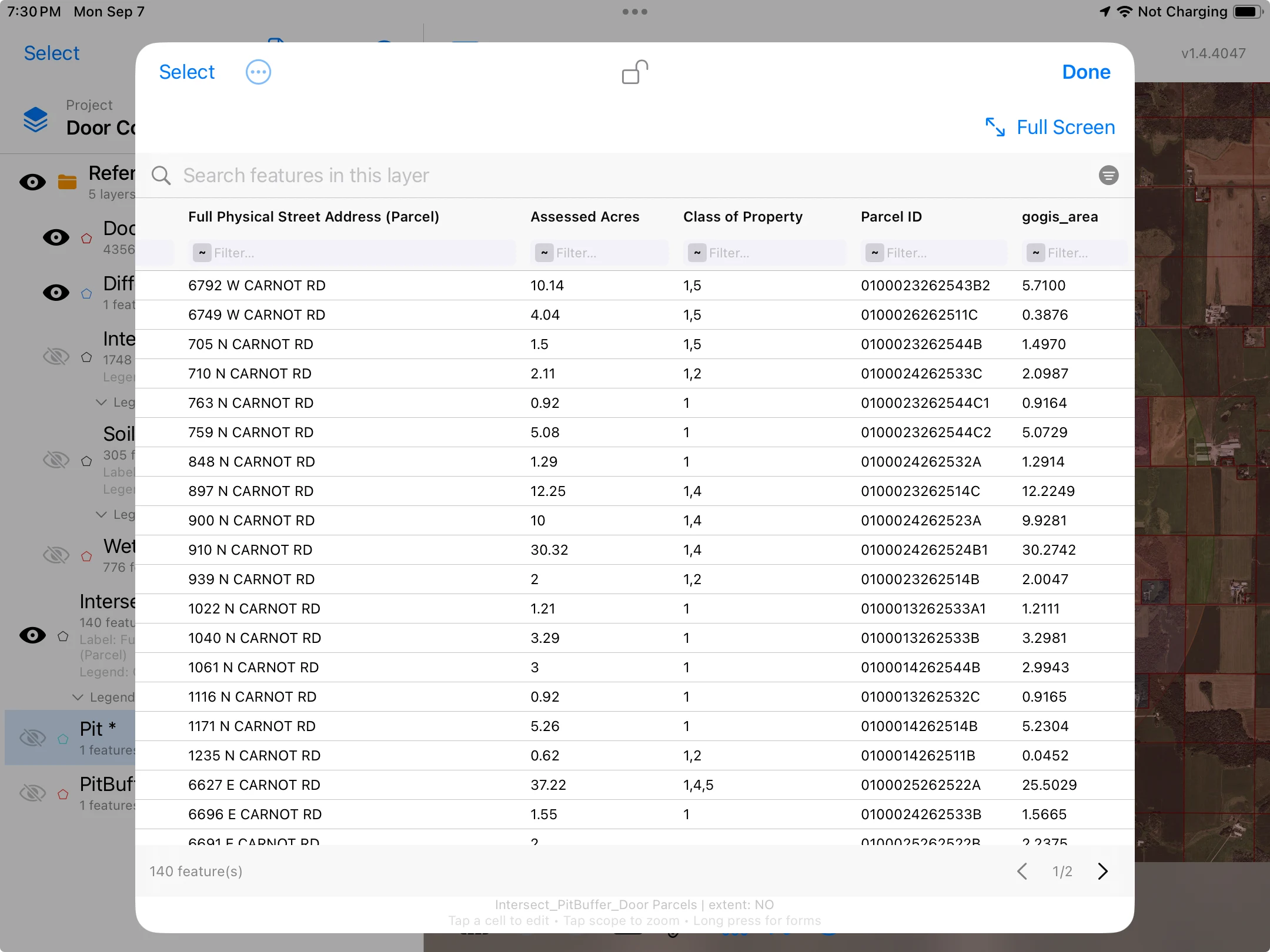
- Work in the Attribute Grid: sort, search, summarize a column, fix a value, or set one value on many rows at once. The attribute table on iPhone and iPad goes through each of these, and the table is the same one on the Mac.
- Answer a question about where things are with Buffer, Intersect, Difference and Dissolve. Each writes a new layer with its own table. See buffer, intersect, difference and dissolve.
Save Exports with the Mac's Save Dialog
When you export, GoGIS opens the standard macOS Save dialog, so you choose the folder and the file lands there. That covers:
- Layers as Shapefile, GeoPackage, GeoJSON, KML or CSV. A shapefile export can be written in a coordinate system for your area, such as a US State Plane zone.
- The Attribute Grid as a CSV, ready for a spreadsheet.
- Sample bag labels, as a sheet of QR or barcode labels to print.
- Heat-map PDFs of an interpolated sampling result.
The Mac at the Desk, the iPhone in the Field
GoGIS on a Mac is the desk half of the job. The field half is on iPhone and iPad, where there's GPS, a camera and a screen you can carry. Collecting points, filling forms with photos, scanning bag barcodes and syncing with the crew are built for those devices: see GPS field data collection and soil sampling.
Moving a layer between them is ordinary file handling. Export it from one device, as a GeoPackage for everything in one file, then AirDrop it or put it in iCloud Drive and open it in GoGIS on the other.
Everything GoGIS does on iPhone and iPad, from Reference Data to offline maps, is on the GIS software for iPad and iPhone page.
Questions
Does GoGIS run on an Intel Mac?
No. GoGIS runs on Macs with Apple silicon, M1 or later, because it runs there as the iPad app. Intel Macs can't run iPad apps.
Is the Mac version a different app?
No. It's the same GoGIS as on iPad, installed from the App Store. What changes on a Mac is how files come and go: imports use the Mac's own Open panel and exports use its Save dialog.
Can I open a shapefile on a Mac?
Yes. Choose the shapefile's ZIP in the Open panel and GoGIS unzips it, reads the .prj and makes a layer with every attribute. GeoPackage, KML, KMZ, GeoJSON and CSV open the same way.
Can I collect GPS points on a Mac?
No. A Mac has no GPS. Collect in the field on an iPhone or iPad, and use the Mac to review, analyze and export.
Do I have to buy it again for my Mac?
No. The App Store purchase is tied to your Apple account, so you can install GoGIS on your compatible iPhone, iPad and Mac without buying it again.
Open a shapefile on your Mac today
GoGIS for Macs with Apple silicon, iPhone and iPad.
Get GoGIS on the App Store