How to Open a GeoJSON File on iPhone & iPad
GeoJSON is the map format of the web. Open data portals offer it as a download button, web maps export it, and developers send it around because it's plain text that any program can read. It's also the format people most often get stuck with on a phone: tap a .geojson file on an iPhone and you usually see a wall of brackets and numbers, not a map.
GoGIS turns that text back into a map. Points, lines and polygons appear in their real place, and every property becomes a column in a table you can work with in the field, with no signal.
What Is a GeoJSON File?
A GeoJSON file is a text file that lists features. Each feature has a shape (a point, a line or a polygon, written as longitude and latitude) and a set of properties: name, ID, date, type, whatever the author included. Think of it as a spreadsheet where every row also carries its shape.
Files usually end in .geojson, sometimes in plain .json. Unlike a shapefile, it's a single file, so there's nothing to zip or keep together. New to GIS files? Start here for how GeoJSON compares with shapefiles, GeoPackage and KML.
Opening a GeoJSON File on Your iPhone or iPad
From Files, Mail, AirDrop or Messages: tap the .geojson file, tap the Share button and choose GoGIS. GoGIS imports it as a new layer and shows it on the map.
From inside GoGIS: open the Layers panel, tap the import button (the page with a plus), choose Import File and pick the file from iCloud Drive, On My iPhone or any cloud storage connected to Files.
A .zip with GeoJSON inside works too; GoGIS unpacks it for you.
Exploring the Features on the Map
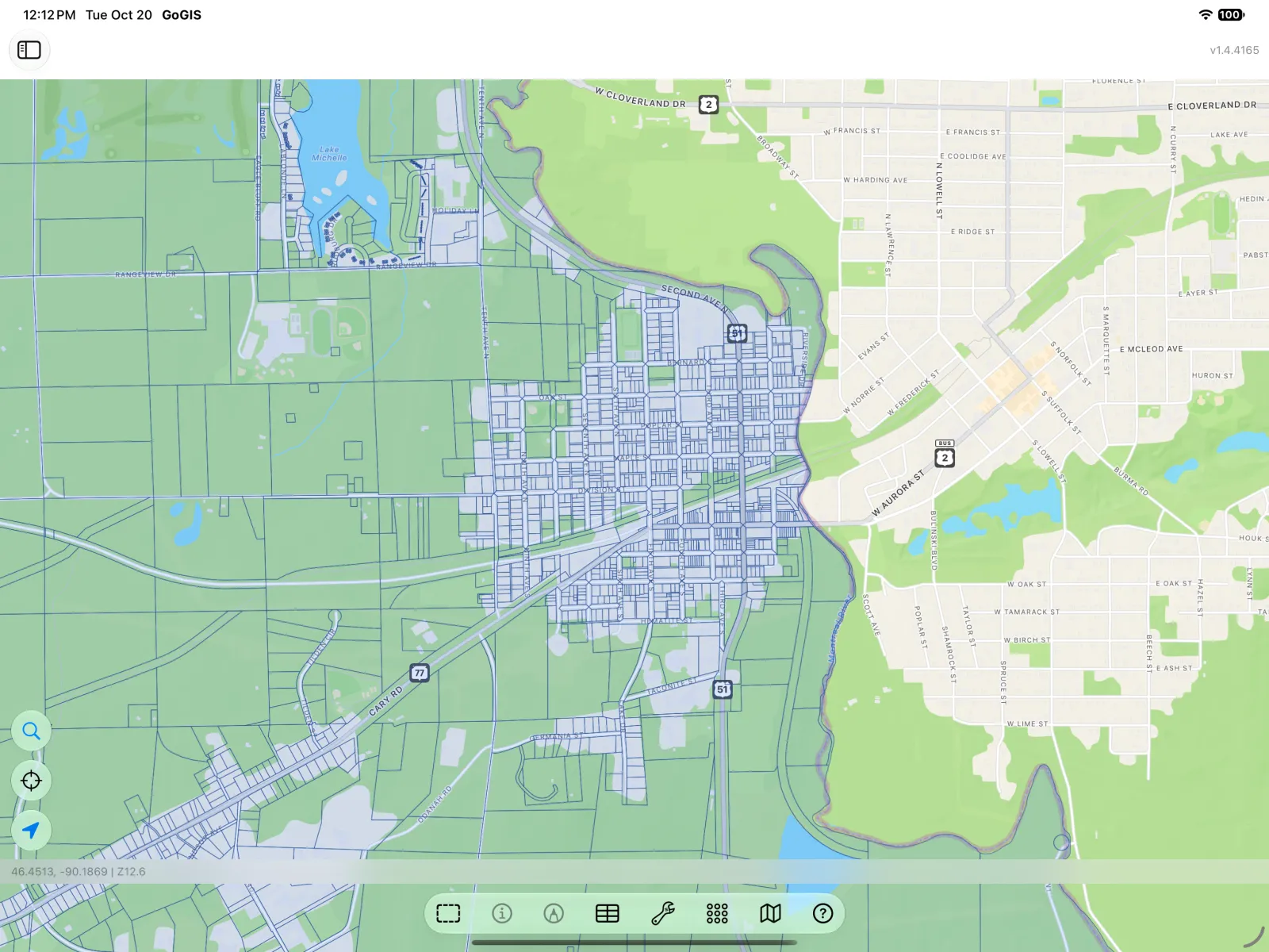
The new layer appears in the Layers panel, where you can show or hide it, change its colors, and label features by any property. Tap a feature on the map to see all of its properties at once.
Every Property in a Table
Open the layer menu (…) beside the layer and choose the Attribute Grid. Each feature is a row and each property is a column. GoGIS keeps the types: numbers stay numbers (so you can sort them and see totals and averages), true/false values stay true/false, and nested properties are kept as readable text rather than thrown away.
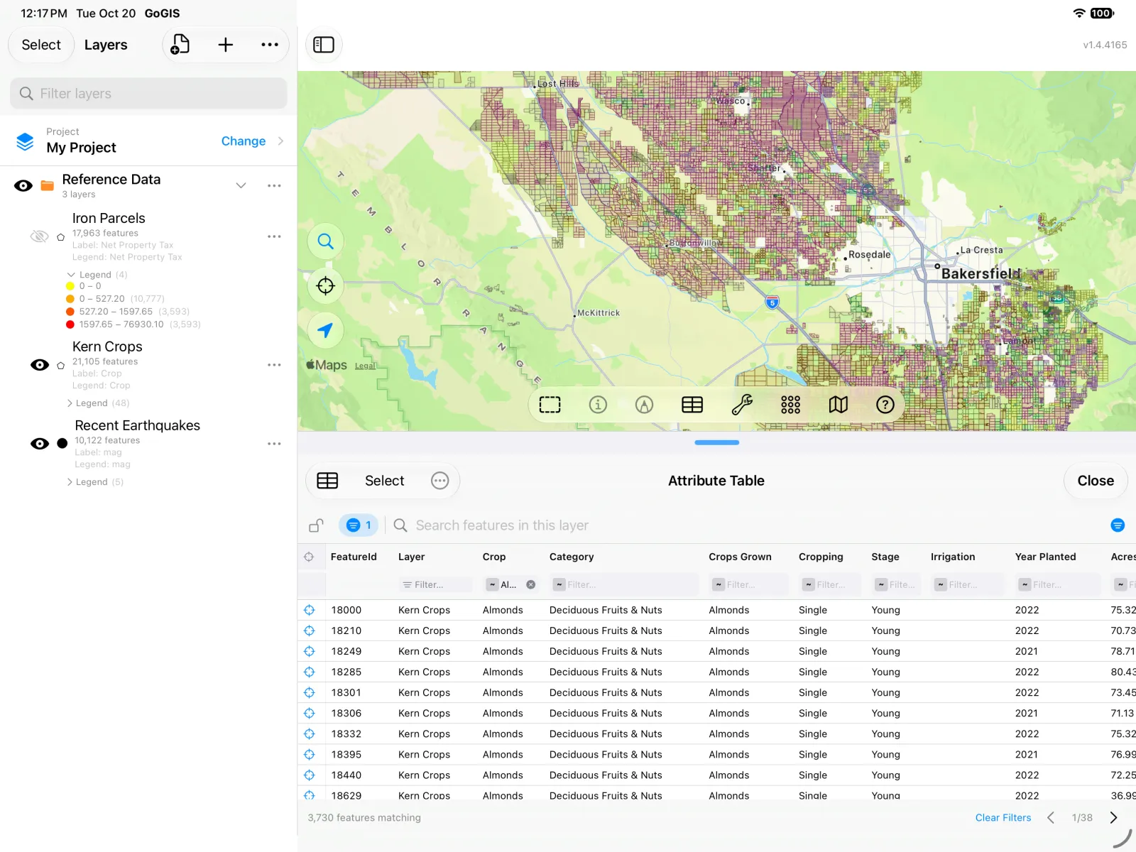
Search, filter and sort the rows, select features on the map from the table, or correct a value right in its cell. Our guide to the attribute table on iPhone and iPad walks through it.
Exporting Back to GeoJSON
When you're done, export the layer again as GeoJSON, or as a shapefile, KML, GeoPackage or CSV for someone who needs a different format. Anything you collected or edited in the field goes with it.
Tips for GeoJSON on iPhone and iPad
- Longitude and latitude, please. Standard GeoJSON is in WGS 84 (EPSG:4326). Older files that name a different coordinate system in a
crsentry are converted automatically. If a file holds projected coordinates (big numbers like 500000, 4300000) with nocrs, GoGIS will say so: export it again as WGS 84 GeoJSON. - One file, one layer. GoGIS makes one layer from each file, so keep points, lines and polygons in separate files.
- Big files are fine. GoGIS reads GeoJSON a feature at a time, so files of hundreds of megabytes import without running out of memory.
- Offline once imported. The features are stored on the device; the map and the table work with no connection.
- Android too. GoGIS for Android opens GeoJSON the same way.
Whether it came from an open data portal, a web map or a colleague's script, a GeoJSON file belongs on a map, and with GoGIS that map is in your pocket.